
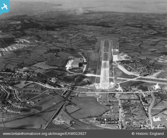
EAW013927 ENGLAND (1948). Bristol Filton Airport and the surrounding area, Bristol, 1948. This image has been produced from a print.
© Copyright OpenStreetMap contributors and licensed by the OpenStreetMap Foundation. 2024. Cartography is licensed as CC BY-SA.
Nearby Images (48)
EAW026974
 at Bristol Filton Airport, Bristol, 1949. This image has been produced from a print marked by Aerofilms Ltd for photo editing.")
EAW016119
 nearing completion at Bristol Filton Airport, Bristol, from the north-west, 1948. This image has been produced from a damaged negative.")
EAW013942
 under construction at Bristol Filton Airport, Bristol, 1948. This image has been produced from a print.")
EAW027409
 at Bristol Filton Airport, Bristol, from the north, 1949. This image has been produced from a print marked by Aerofilms Ltd for photo editing.")
EAW024893
 at Bristol Filton Airport, Bristol, 1949. This image was marked by Aerofilms Ltd for photo editing.")
EAW019145
 at Bristol Filton Airport, Bristol, from the north-west, 1948")
EAW017472
 nearing completion at Bristol Filton Airport, Bristol, 1948. This image has been produced from a print.")
EAW026978
 at Bristol Filton Airport, Bristol, 1949. This image has been produced from a print.")
EAW013029
 under construction at Bristol Filton Airport, Bristol, 1948. This image has been produced from a print.")
EAW017490
 nearing completion at Bristol Filton Airport, Bristol, 1948")
EAW020946
 at Bristol Filton Airport, Bristol, 1949")
EAW009934
 under construction at Bristol Filton Airport, Bristol, 1947")
EAW013930
 under construction at Bristol Filton Airport, Bristol, 1948. This image has been produced from a print.")
EAW026979
 at Bristol Filton Airport, Bristol, 1949. This image has been produced from a print.")
EAW016131
 nearing completion at Bristol Filton Airport, Bristol, 1948. This image has been produced from a damaged negative.")
EAW020949
 at Bristol Filton Airport, Bristol, from the north, 1949")
EAW016126
 nearing completion at Bristol Filton Airport, Bristol, 1948. This image has been produced from a damaged negative.")
EAW024902
 at Bristol Filton Airport, Bristol, from the north, 1949")
EAW020936
 at Bristol Filton Airport, Bristol, 1949")
EAW024891
 at Bristol Filton Airport, Bristol, 1949. This image was marked by Aerofilms Ltd for photo editing.")
EAW026949
 at Bristol Filton Airport, Bristol, from the north-west, 1949. This image has been produced from a print.")
EAW026952
 at Bristol Filton Airport, Bristol, from the south, 1949. This image has been produced from a print.")
EAW011963
 under construction at Bristol Filton Airport, Bristol, 1947")
EAW017479
 nearing completion at Bristol Filton Airport, Bristol, 1948")
EAW011954
 under construction at Bristol Filton Airport, Bristol, 1947")
EAW020943
 at Bristol Filton Airport, Bristol, from the south, 1949. This image was marked by Aerofilms Ltd for photo editing.")
EAW013035
 under construction at Bristol Filton Airport, Bristol, 1948. This image has been produced from a damaged negative.")
EAW011959
 under construction at Bristol Filton Airport, Bristol, 1947")
EAW023251
 at Bristol Filton Airport, Bristol, 1949. This image was marked by Aerofilms Ltd for photo editing.")
EAW013026
 under construction at Bristol Filton Airport, Bristol, 1948. This image has been produced from a print.")
EAW017482
 nearing completion at Bristol Filton Airport, Bristol, 1948")
EAW020584
 at Bristol Filton Airport, Bristol, 1948. This image was marked by Aerofilms Ltd for photo editing.")
EAW013022
 under construction at Bristol Filton Airport, Bristol, from the west, 1948. This image has been produced from a print.")
EAW020924
 at Bristol Filton Airport, Bristol, 1949")
EAW013036
 under construction at Bristol Filton Airport, Bristol, 1948")
EAW013938
 at Bristol Filton Airport, Bristol, 1948. This image has been produced from a damaged negative.")
EAW016125
 nearing completion at Bristol Filton Airport, Bristol, 1948. This image has been produced from a damaged negative.")
EAW024892
 at Bristol Filton Airport, Bristol, 1949. This image was marked by Aerofilms Ltd for photo editing.")
EAW017486
 nearing completion at Bristol Filton Airport, Bristol, 1948")
EAW007034
 under construction at Bristol Filton Airport, Bristol, from the west, 1947")
EAW011955
 under construction at Bristol Filton Airport, Bristol, from the south-west, 1947")
EAW019144
 at Bristol Filton Airport, Bristol, from the south, 1948. This image was marked by Aerofilms Ltd for photo editing.")
EAW024899
 at Bristol Filton Airport, Bristol, 1949")
EAW011964
 under construction at Bristol Filton Airport, Bristol, from the south-west, 1947")
EAW019137
 at Bristol Filton Airport, Bristol, from the south, 1948")
EAW019143
 at Bristol Filton Airport, Bristol, from the south-west, 1948. This image was marked by Aerofilms Ltd for photo editing.")
EAW016120
 nearing completion at Bristol Filton Airport, Bristol, 1948. This image has been produced from a damaged negative.")
EAW011958
 under construction at Bristol Filton Airport, Bristol, from the south-west, 1947")
Details
| Title | [EAW013927] Bristol Filton Airport and the surrounding area, Bristol, 1948. This image has been produced from a print. |
| Reference | EAW013927 |
| Date | 22-March-1948 |
| Link | |
| Place name | BRISTOL |
| Parish | |
| District | |
| Country | ENGLAND |
| Easting / Northing | 359570, 179953 |
| Longitude / Latitude | -2.5827274132134, 51.516569084625 |
| National Grid Reference | ST596800 |
Pins
Be the first to add a comment to this image!