
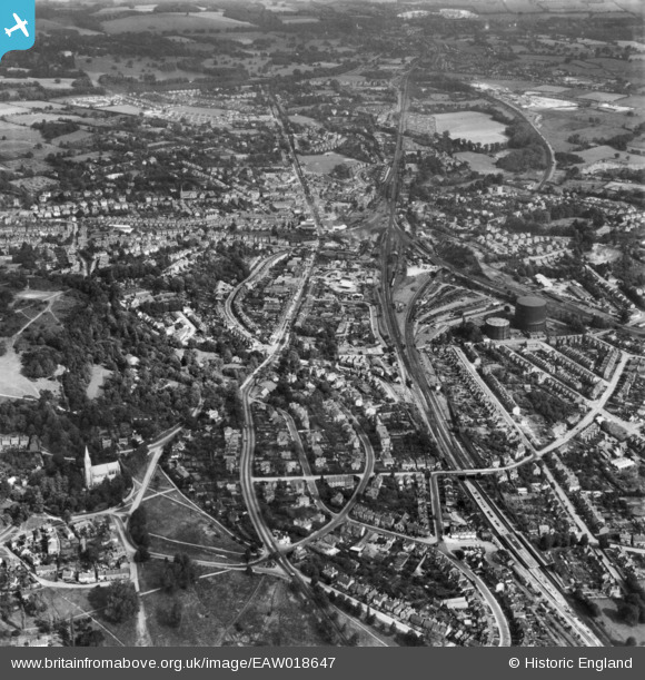
EAW018647 ENGLAND (1948). The town, Redhill, 1948. This image has been produced from a print.
© Copyright OpenStreetMap contributors and licensed by the OpenStreetMap Foundation. 2024. Cartography is licensed as CC BY-SA.
Details
| Title | [EAW018647] The town, Redhill, 1948. This image has been produced from a print. |
| Reference | EAW018647 |
| Date | 9-September-1948 |
| Link | |
| Place name | REDHILL |
| Parish | |
| District | |
| Country | ENGLAND |
| Easting / Northing | 527785, 149839 |
| Longitude / Latitude | -0.16949165754016, 51.232895550887 |
| National Grid Reference | TQ278498 |
Pins
 John Wass |
Saturday 11th of April 2015 09:09:57 PM | |
John Wass |
Saturday 11th of April 2015 09:08:47 PM | |
 Class31 |
Saturday 1st of November 2014 08:14:56 AM | |
BruceR |
Thursday 11th of September 2014 10:18:47 PM | |
BruceR |
Wednesday 10th of September 2014 09:57:58 PM | |
BruceR |
Wednesday 10th of September 2014 09:56:21 PM | |
Class31 |
Monday 1st of September 2014 12:08:31 AM |