
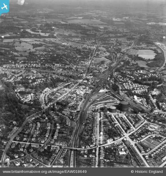
EAW018649 ENGLAND (1948). The town, Redhill, 1948. This image has been produced from a print.
© Copyright OpenStreetMap contributors and licensed by the OpenStreetMap Foundation. 2024. Cartography is licensed as CC BY-SA.
Details
| Title | [EAW018649] The town, Redhill, 1948. This image has been produced from a print. |
| Reference | EAW018649 |
| Date | 9-September-1948 |
| Link | |
| Place name | REDHILL |
| Parish | |
| District | |
| Country | ENGLAND |
| Easting / Northing | 527900, 150176 |
| Longitude / Latitude | -0.16772484914648, 51.235898843557 |
| National Grid Reference | TQ279502 |
Pins
 BruceR |
Monday 28th of January 2019 08:44:25 PM | |
 Class31 |
Saturday 1st of November 2014 08:15:31 AM | |
Class31 |
Saturday 1st of November 2014 08:11:05 AM | |
brianbeckett |
Friday 26th of September 2014 02:08:14 PM | |
BruceR |
Thursday 11th of September 2014 10:25:29 PM | |
BruceR |
Wednesday 10th of September 2014 09:51:40 PM | |
BruceR |
Wednesday 10th of September 2014 09:50:04 PM | |
BruceR |
Wednesday 10th of September 2014 09:45:51 PM | |
BruceR |
Wednesday 10th of September 2014 09:45:10 PM |
