
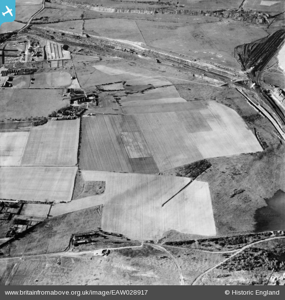
EAW028917 ENGLAND (1950). Conesby Farm and environs, Scunthorpe, 1950
© Copyright OpenStreetMap contributors and licensed by the OpenStreetMap Foundation. 2024. Cartography is licensed as CC BY-SA.
Details
| Title | [EAW028917] Conesby Farm and environs, Scunthorpe, 1950 |
| Reference | EAW028917 |
| Date | 5-May-1950 |
| Link | |
| Place name | SCUNTHORPE |
| Parish | |
| District | |
| Country | ENGLAND |
| Easting / Northing | 489736, 413517 |
| Longitude / Latitude | -0.64348898576683, 53.610273713787 |
| National Grid Reference | SE897135 |
Pins
 James Wells |
Sunday 14th of April 2024 02:50:31 PM |