
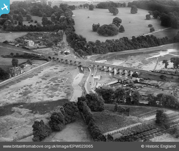
EPW023065 ENGLAND (1928). Viaduct at Cams Hill, Fareham, 1928
© Copyright OpenStreetMap contributors and licensed by the OpenStreetMap Foundation. 2024. Cartography is licensed as CC BY-SA.
Details
| Title | [EPW023065] Viaduct at Cams Hill, Fareham, 1928 |
| Reference | EPW023065 |
| Date | August-1928 |
| Link | |
| Place name | FAREHAM |
| Parish | |
| District | |
| Country | ENGLAND |
| Easting / Northing | 458681, 106259 |
| Longitude / Latitude | -1.1662840344713, 50.852309165499 |
| National Grid Reference | SU587063 |
Pins
 Josharpr |
Friday 11th of June 2021 03:56:56 PM | |
Josharpr |
Friday 11th of June 2021 03:56:09 PM | |
adfbristol |
Wednesday 26th of June 2013 01:29:12 AM |