
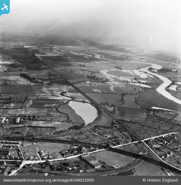
EAW021895 ENGLAND (1949). The Long Eaton Junction and flooding around the River Trent, Long Eaton, from the west, 1949. This image has been produced from a print.
© Hawlfraint cyfranwyr OpenStreetMap a thrwyddedwyd gan yr OpenStreetMap Foundation. 2025. Trwyddedir y gartograffeg fel CC BY-SA.
Manylion
| Pennawd | [EAW021895] The Long Eaton Junction and flooding around the River Trent, Long Eaton, from the west, 1949. This image has been produced from a print. |
| Cyfeirnod | EAW021895 |
| Dyddiad | 8-April-1949 |
| Dolen | |
| Enw lle | LONG EATON |
| Plwyf | |
| Ardal | |
| Gwlad | ENGLAND |
| Dwyreiniad / Gogleddiad | 450105, 333145 |
| Hydred / Lledred | -1.2551549700615, 52.893095625585 |
| Cyfeirnod Grid Cenedlaethol | SK501331 |
Pinnau
Byddwch y cyntaf i ychwanegu sylw at y ddelwedd hon!