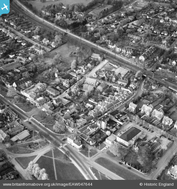
EAW047644 ENGLAND (1952). Harpenden Public Halls and Vaughan Road, Harpenden, 1952
© Hawlfraint cyfranwyr OpenStreetMap a thrwyddedwyd gan yr OpenStreetMap Foundation. 2024. Trwyddedir y gartograffeg fel CC BY-SA.
Delweddau cyfagos (5)
Manylion
| Pennawd | [EAW047644] Harpenden Public Halls and Vaughan Road, Harpenden, 1952 |
| Cyfeirnod | EAW047644 |
| Dyddiad | 27-October-1952 |
| Dolen | |
| Enw lle | HARPENDEN |
| Plwyf | HARPENDEN |
| Ardal | |
| Gwlad | ENGLAND |
| Dwyreiniad / Gogleddiad | 513566, 214268 |
| Hydred / Lledred | -0.35230727999802, 51.815042244896 |
| Cyfeirnod Grid Cenedlaethol | TL136143 |
Pinnau
 Matt Aldred edob.mattaldred.com |
Sunday 3rd of October 2021 11:28:52 AM | |
 John Wass |
Friday 20th of October 2017 02:22:05 PM | |
 John W |
Sunday 5th of March 2017 07:35:04 PM | |
 John W |
Sunday 5th of March 2017 07:33:47 PM | |
 John W |
Sunday 5th of March 2017 07:33:11 PM | |
 John W |
Sunday 5th of March 2017 07:32:44 PM | |
 John W |
Thursday 1st of September 2016 09:36:19 PM | |
 John Wass |
Friday 8th of August 2014 09:14:05 PM | |
Down Slow line - left hand arm controls trains crossing over to the Down Fast line a little north of the bridge. |
 John W |
Thursday 1st of September 2016 09:35:09 PM |


![[EAW047644] Harpenden Public Halls and Vaughan Road, Harpenden, 1952](http://britainfromabove.org.uk/sites/all/libraries/aerofilms-images/public/100x100/EAW/047/EAW047644.jpg)
![[EPW023930] Leyton Green and the High Street, Harpenden, 1928](http://britainfromabove.org.uk/sites/all/libraries/aerofilms-images/public/100x100/EPW/023/EPW023930.jpg)
![[EPW023932] Church Green and the War Memorial, Harpenden, 1928](http://britainfromabove.org.uk/sites/all/libraries/aerofilms-images/public/100x100/EPW/023/EPW023932.jpg)
![[EPW023931] Leyton Green and environs, Harpenden, 1928](http://britainfromabove.org.uk/sites/all/libraries/aerofilms-images/public/100x100/EPW/023/EPW023931.jpg)
![[EPW023925] Church Green and the War Memorial, Harpenden, 1928](http://britainfromabove.org.uk/sites/all/libraries/aerofilms-images/public/100x100/EPW/023/EPW023925.jpg)