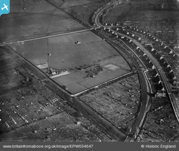
EPW034647 ENGLAND (1930). Reckitt's Recreation Ground, Kingston upon Hull, 1930
© Hawlfraint cyfranwyr OpenStreetMap a thrwyddedwyd gan yr OpenStreetMap Foundation. 2024. Trwyddedir y gartograffeg fel CC BY-SA.
Manylion
| Pennawd | [EPW034647] Reckitt's Recreation Ground, Kingston upon Hull, 1930 |
| Cyfeirnod | EPW034647 |
| Dyddiad | 16-October-1930 |
| Dolen | |
| Enw lle | KINGSTON UPON HULL |
| Plwyf | |
| Ardal | |
| Gwlad | ENGLAND |
| Dwyreiniad / Gogleddiad | 510797, 430782 |
| Hydred / Lledred | -0.31908383457198, 53.761374414299 |
| Cyfeirnod Grid Cenedlaethol | TA108308 |
Pinnau
 John Wass |
Tuesday 4th of July 2017 03:20:08 PM | |
 John Wass |
Monday 25th of May 2015 04:01:37 PM | |
 HullPaul |
Wednesday 6th of August 2014 07:40:38 PM | |
 CartoonHead |
Tuesday 20th of August 2013 08:45:33 PM |


![[EPW034647] Reckitt's Recreation Ground, Kingston upon Hull, 1930](http://britainfromabove.org.uk/sites/all/libraries/aerofilms-images/public/100x100/EPW/034/EPW034647.jpg)
![[EPW034659] Reckitt's Recreation Ground, Kingston upon Hull, 1930](http://britainfromabove.org.uk/sites/all/libraries/aerofilms-images/public/100x100/EPW/034/EPW034659.jpg)
![[EPW034654] Reckitt's Recreation Ground, Kingston upon Hull, 1930](http://britainfromabove.org.uk/sites/all/libraries/aerofilms-images/public/100x100/EPW/034/EPW034654.jpg)
![[EPW034658] Reckitt's Recreation Ground and the Garden Village, Kingston upon Hull, 1930](http://britainfromabove.org.uk/sites/all/libraries/aerofilms-images/public/100x100/EPW/034/EPW034658.jpg)