
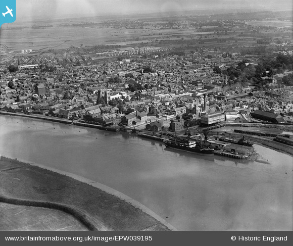
EPW039195 ENGLAND (1932). Friars Fleet and the town, King's Lynn, from the south-west, 1932
© Hawlfraint cyfranwyr OpenStreetMap a thrwyddedwyd gan yr OpenStreetMap Foundation. 2025. Trwyddedir y gartograffeg fel CC BY-SA.
Manylion
| Pennawd | [EPW039195] Friars Fleet and the town, King's Lynn, from the south-west, 1932 |
| Cyfeirnod | EPW039195 |
| Dyddiad | July-1932 |
| Dolen | |
| Enw lle | KING'S LYNN |
| Plwyf | |
| Ardal | |
| Gwlad | ENGLAND |
| Dwyreiniad / Gogleddiad | 561639, 319479 |
| Hydred / Lledred | 0.39507298396629, 52.748383786882 |
| Cyfeirnod Grid Cenedlaethol | TF616195 |
Pinnau
 incony |
Wednesday 16th of August 2023 07:33:36 AM | |
Peter |
Sunday 29th of December 2019 09:21:36 PM | |
Peter |
Sunday 29th of December 2019 09:15:34 PM | |
Peter |
Sunday 29th of December 2019 09:12:59 PM |
Cyfraniadau Grŵp
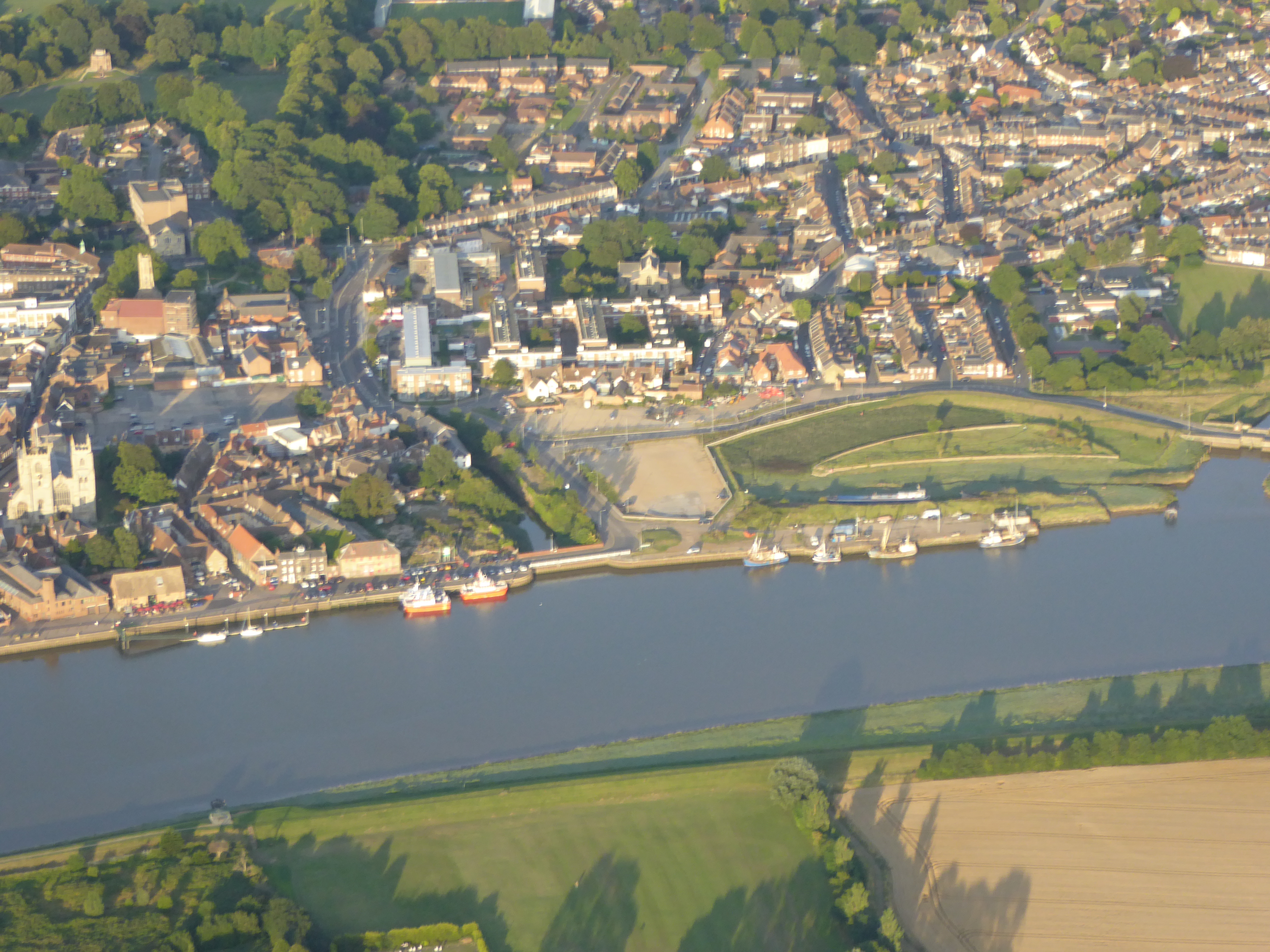 This contemporary point and click view of Kings Lynn from above was taken on the 12 August 2015 from an open cockpit flexwing microlight aircraft at approximately 2000ft. The camera was a Lumix TZ60. The cameras internal GPS gives its Lat/Long position as 52° 45' 29"N 0° 22' 1.7"E and time as 18:32:55(UTC) when the photograph was taken. |
SMFurner |
Friday 14th of August 2015 04:13:23 AM |