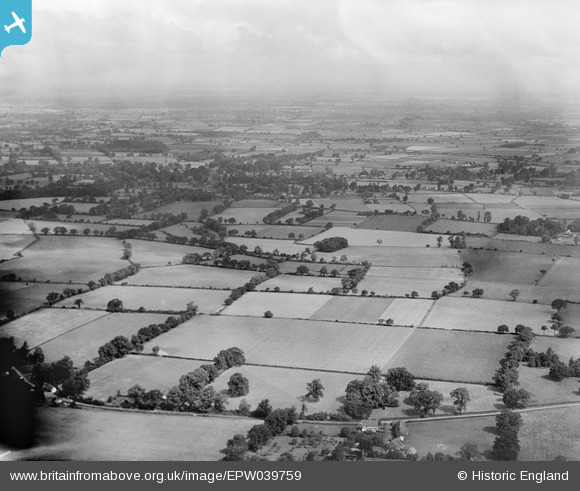
EPW039759 ENGLAND (1932). Farmland, Badwell Ash, from the south, 1932
© Hawlfraint cyfranwyr OpenStreetMap a thrwyddedwyd gan yr OpenStreetMap Foundation. 2025. Trwyddedir y gartograffeg fel CC BY-SA.
Manylion
| Pennawd | [EPW039759] Farmland, Badwell Ash, from the south, 1932 |
| Cyfeirnod | EPW039759 |
| Dyddiad | August-1932 |
| Dolen | |
| Enw lle | BADWELL ASH |
| Plwyf | BADWELL ASH |
| Ardal | |
| Gwlad | ENGLAND |
| Dwyreiniad / Gogleddiad | 600792, 269248 |
| Hydred / Lledred | 0.94412951427779, 52.284238030245 |
| Cyfeirnod Grid Cenedlaethol | TM008692 |
Pinnau
 TomRobin |
Wednesday 6th of November 2013 11:31:43 PM | |
 TomRobin |
Wednesday 6th of November 2013 11:28:46 PM | |
 TomRobin |
Wednesday 6th of November 2013 11:17:10 PM | |
 TomRobin |
Wednesday 6th of November 2013 11:14:52 PM | |
 TomRobin |
Wednesday 6th of November 2013 11:12:42 PM | |
 TomRobin |
Wednesday 6th of November 2013 11:11:39 PM | |
 Class31 |
Monday 8th of July 2013 09:18:07 AM | |
These semis are on Grove Rd, Walsham le Willows |
 TomRobin |
Wednesday 6th of November 2013 11:25:12 PM |
 Class31 |
Monday 8th of July 2013 09:15:47 AM | |
Church with tower on The Causeway Walsham Le Willows |
 TomRobin |
Wednesday 6th of November 2013 11:27:40 PM |
 Rebecca |
Sunday 26th of May 2013 03:24:08 PM |
Cyfraniadau Grŵp
This is just west of Badwell Green, looking north towards Walsham the willows. |
 TomRobin |
Wednesday 8th of January 2014 09:37:50 AM |
Another fantastic find. Spot on Tom Robin! |
 Class31 |
Wednesday 6th of November 2013 11:39:51 PM |
Hi TomRobin, Thanks for looking into this image. We'll update the catalogue and post the new data here in due course. Yours, Katy Britain from Above Cataloguing Team Leader |
Katy Whitaker |
Wednesday 8th of January 2014 09:37:50 AM |
View looking north. |
 Class31 |
Wednesday 6th of November 2013 11:34:46 PM |
The previous picture is of Gosfield, near Halstead in Essex, while the next picture is of Bracon Ash, just to the south west of Norwich. Suffolk is a big county and mostly arable farming. This is a big picture and mostly arable. It suggests a random picture taken between the above two places. There is insufficient detail or prominent features to make a judgement of the exact location. |
 Maurice |
Friday 21st of June 2013 06:38:21 PM |

