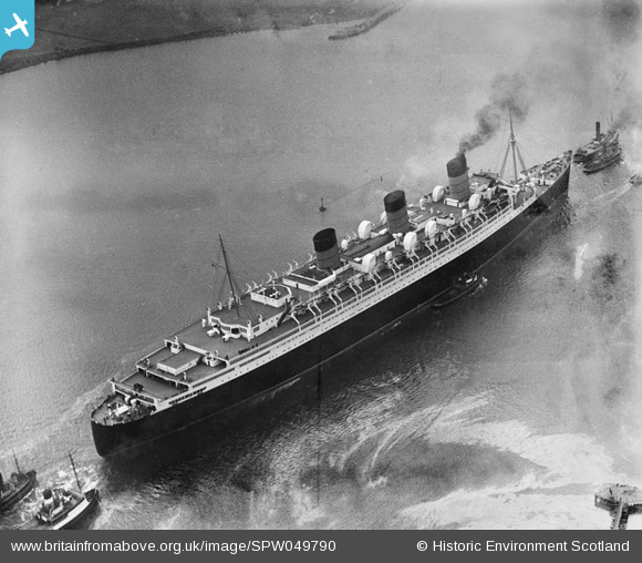
SPW049790 SCOTLAND (1936). Queen Mary, River Clyde, Bowling. An oblique aerial photograph taken facing south-west.
© Hawlfraint cyfranwyr OpenStreetMap a thrwyddedwyd gan yr OpenStreetMap Foundation. 2024. Trwyddedir y gartograffeg fel CC BY-SA.
Manylion
| Pennawd | [SPW049790] Queen Mary, River Clyde, Bowling. An oblique aerial photograph taken facing south-west. |
| Cyfeirnod | SPW049790 |
| Dyddiad | 1936 |
| Dolen | Canmore Collection item 1257790 |
| Enw lle | |
| Plwyf | OLD KILPATRICK (DUMBARTON) |
| Ardal | DUMBARTON |
| Gwlad | SCOTLAND |
| Dwyreiniad / Gogleddiad | 243191, 673423 |
| Hydred / Lledred | -4.5101593143798, 55.928303164542 |
| Cyfeirnod Grid Cenedlaethol | NS432734 |
Pinnau
 ewnmcg |
Tuesday 22nd of January 2013 08:58:50 PM |
Cyfraniadau Grŵp
Dear ewnmcg, That's great; we've reviewed your comments and thanks to your help we can update the catalogue. The revised record will appear here in due course. Hope you have the same success solving some of our other mysteries! Brian Wilkinson Britain from Above Activity Officer (Scotland) |
 Brian Wilkinson |
Thursday 14th of March 2013 10:10:47 AM |
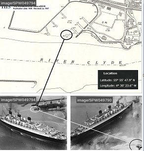
If you compare the jetty on this image with that on SPW049794 you will note tha two mooring ropes and the little group of men. |
 ewnmcg |
Thursday 24th of January 2013 02:39:12 PM |
 Just west of Dunglass Castle, on River Clyde. I rest my case. |
 ewnmcg |
Saturday 15th of December 2012 08:04:47 PM |
Passing Bowling heading downriver. |
 Weechookieburdie |
Wednesday 24th of October 2012 01:38:03 AM |
Note also Image reference SPW049794 - Date 24th March 1936. It was probably taken a minute or so earlier and shows the jetty in its entirety and all of the inlet on the north bank of the river. The boat which is moored in the inlet is positioned such as not to appear in this image, i.e. in SPW049790. |
 ewnmcg |
Friday 27th of July 2012 03:43:53 PM |
Note also Image Ref SPW019463 (Oct 1927) which I believe has the same jetty but not showing the tip of it. |
 ewnmcg |
Thursday 19th of July 2012 08:50:39 AM |
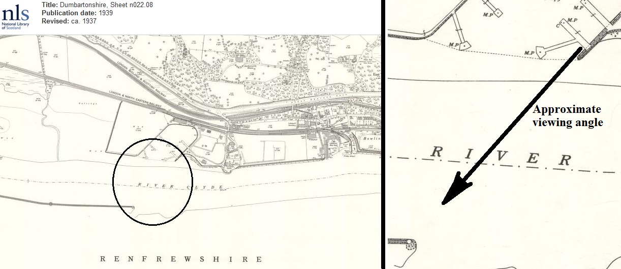
 I have 'scanned' the river downstream from Clydebank to a point where it becomes much wider than shown in the photo. The inshot on the north bank with mooring jetties, and just west of Dunglass Castle, is a strong candidate. I attach Ordnance Survey map of 1937 - it is best evidence I have obtained so far. |
 ewnmcg |
Monday 9th of July 2012 07:02:11 PM |

