
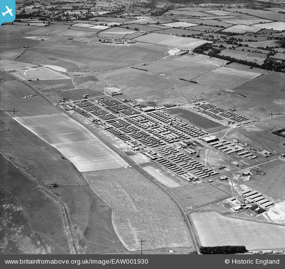
EAW001930 ENGLAND (1946). RAF Yatesbury, Yatesbury, from the south-east, 1946
© Copyright OpenStreetMap contributors and licensed by the OpenStreetMap Foundation. 2025. Cartography is licensed as CC BY-SA.
Details
| Title | [EAW001930] RAF Yatesbury, Yatesbury, from the south-east, 1946 |
| Reference | EAW001930 |
| Date | 12-July-1946 |
| Link | |
| Place name | YATESBURY |
| Parish | CHERHILL |
| District | |
| Country | ENGLAND |
| Easting / Northing | 406826, 169861 |
| Longitude / Latitude | -1.9018075667879, 51.427222417571 |
| National Grid Reference | SU068699 |
Pins
 mikanmart |
Thursday 24th of July 2014 11:49:04 PM | |
 Class31 |
Saturday 8th of February 2014 07:44:18 PM | |
Class31 |
Saturday 8th of February 2014 07:42:27 PM | |
Class31 |
Saturday 8th of February 2014 07:39:36 PM | |
Class31 |
Saturday 24th of August 2013 11:38:11 PM | |
bayleaf |
Friday 23rd of August 2013 04:10:23 PM | |
bayleaf |
Friday 23rd of August 2013 04:09:46 PM | |
bayleaf |
Friday 23rd of August 2013 04:09:17 PM | |
I am afraid you are wrong , the Domestic site for the old RAF Cherhill is behind the hangars seen on this view , the domestic site you highlight is the one for No 2 School of Trade Training , RAF Yatesbury . |
mikanmart |
Thursday 24th of July 2014 11:44:47 PM |


User Comment Contributions
It's good to get this long shot with the aerodrome in too. Yatesbury Camp and environs. Yours, Katy |
Katy Whitaker |
Friday 23rd of August 2013 04:38:23 PM |