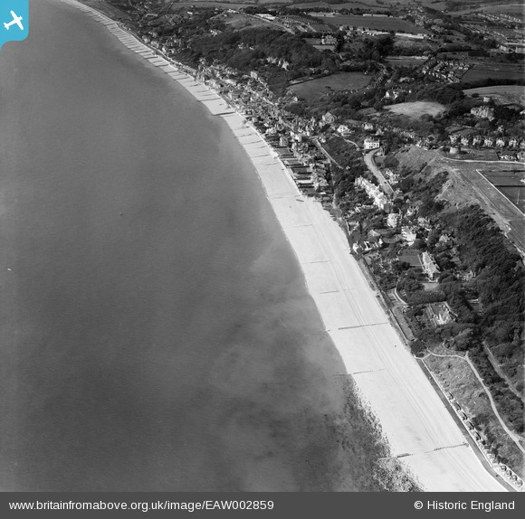
EAW002859 ENGLAND (1946). The village and the seafront, Sandgate, 1946
© Copyright OpenStreetMap contributors and licensed by the OpenStreetMap Foundation. 2024. Cartography is licensed as CC BY-SA.
Nearby Images (9)
Details
| Title | [EAW002859] The village and the seafront, Sandgate, 1946 |
| Reference | EAW002859 |
| Date | 1-October-1946 |
| Link | |
| Place name | SANDGATE |
| Parish | SANDGATE |
| District | |
| Country | ENGLAND |
| Easting / Northing | 621243, 135115 |
| Longitude / Latitude | 1.158511380385, 51.07211487319 |
| National Grid Reference | TR212351 |


![[EAW002859] The village and the seafront, Sandgate, 1946](http://britainfromabove.org.uk/sites/all/libraries/aerofilms-images/public/100x100/EAW/002/EAW002859.jpg)
![[EAW002860] Radnor Cliff, the seafront and the village, Sandgate, 1946](http://britainfromabove.org.uk/sites/all/libraries/aerofilms-images/public/100x100/EAW/002/EAW002860.jpg)
![[EAW032832] Martello Tower no. 4, Radnor Cliff Crescent and the seafront, Sandgate, from the east, 1950. This image was marked by Aerofilms Ltd for photo editing.](http://britainfromabove.org.uk/sites/all/libraries/aerofilms-images/public/100x100/EAW/032/EAW032832.jpg)
![[EPW042871] Radnor Cliff, The Leas and the town, Folkestone, from the south-west, 1933](http://britainfromabove.org.uk/sites/all/libraries/aerofilms-images/public/100x100/EPW/042/EPW042871.jpg)
![[EAW002377] Sandgate Hill and environs, Folkestone, from the east, 1946](http://britainfromabove.org.uk/sites/all/libraries/aerofilms-images/public/100x100/EAW/002/EAW002377.jpg)
![[EPW035412] Martello Tower number 4, Radnor Cliff and the town, Folkestone, from the west, 1931](http://britainfromabove.org.uk/sites/all/libraries/aerofilms-images/public/100x100/EPW/035/EPW035412.jpg)
![[EAW002858] The village and the seafront, Sandgate, 1946](http://britainfromabove.org.uk/sites/all/libraries/aerofilms-images/public/100x100/EAW/002/EAW002858.jpg)
![[EAW032836] Radnor Cliff Crescent, Martello Tower no. 4 and environs, Sandgate, from the south, 1950. This image was marked by Aerofilms Ltd for photo editing.](http://britainfromabove.org.uk/sites/all/libraries/aerofilms-images/public/100x100/EAW/032/EAW032836.jpg)
![[EAW032833] Martello Tower no. 4, Radnor Cliff Crescent and environs, Folkestone, 1950. This image was marked by Aerofilms Ltd for photo editing.](http://britainfromabove.org.uk/sites/all/libraries/aerofilms-images/public/100x100/EAW/032/EAW032833.jpg)
