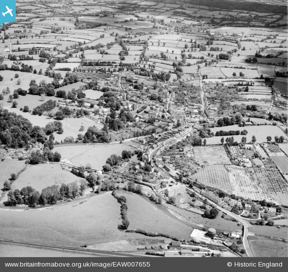
EAW007655 ENGLAND (1947). The town, Ottery St Mary, 1947
© Copyright OpenStreetMap contributors and licensed by the OpenStreetMap Foundation. 2024. Cartography is licensed as CC BY-SA.
Details
| Title | [EAW007655] The town, Ottery St Mary, 1947 |
| Reference | EAW007655 |
| Date | 17-June-1947 |
| Link | |
| Place name | OTTERY ST MARY |
| Parish | OTTERY ST. MARY |
| District | |
| Country | ENGLAND |
| Easting / Northing | 309742, 95486 |
| Longitude / Latitude | -3.2796016971387, 50.751379056785 |
| National Grid Reference | SY097955 |
Pins
 Adrian |
Sunday 29th of September 2024 10:43:07 PM | |
 Charles Dale |
Tuesday 7th of July 2015 09:50:17 PM | |
Allen T |
Thursday 14th of August 2014 06:37:12 PM | |
Allen T |
Thursday 14th of August 2014 06:34:17 PM | |
Allen T |
Thursday 14th of August 2014 06:33:06 PM | |
Allen T |
Thursday 14th of August 2014 06:24:33 PM | |
Allen T |
Thursday 14th of August 2014 06:20:24 PM | |
Allen T |
Thursday 14th of August 2014 06:19:54 PM | |
Allen T |
Thursday 14th of August 2014 06:17:55 PM | |
Allen T |
Thursday 14th of August 2014 06:17:03 PM | |
Allen T |
Thursday 14th of August 2014 06:16:00 PM | |
Allen T |
Thursday 14th of August 2014 06:15:16 PM | |
Allen T |
Thursday 14th of August 2014 06:14:33 PM | |
Allen T |
Thursday 14th of August 2014 05:56:28 PM | |
 MB |
Tuesday 12th of November 2013 11:54:36 PM | |
 Charles Dale |
Wednesday 6th of November 2013 02:22:01 PM | |
 Charles Dale |
Wednesday 6th of November 2013 02:21:14 PM | |
 Charles Dale |
Wednesday 6th of November 2013 02:20:21 PM | |
 Charles Dale |
Wednesday 6th of November 2013 02:19:40 PM | |
 Charles Dale |
Wednesday 6th of November 2013 02:18:53 PM |


![[EAW007655] The town, Ottery St Mary, 1947](http://britainfromabove.org.uk/sites/all/libraries/aerofilms-images/public/100x100/EAW/007/EAW007655.jpg)
![[EAW007654] St Mary's Church and the town, Ottery St Mary, 1947](http://britainfromabove.org.uk/sites/all/libraries/aerofilms-images/public/100x100/EAW/007/EAW007654.jpg)
![[EAW007653] The town, Ottery St Mary, 1947](http://britainfromabove.org.uk/sites/all/libraries/aerofilms-images/public/100x100/EAW/007/EAW007653.jpg)