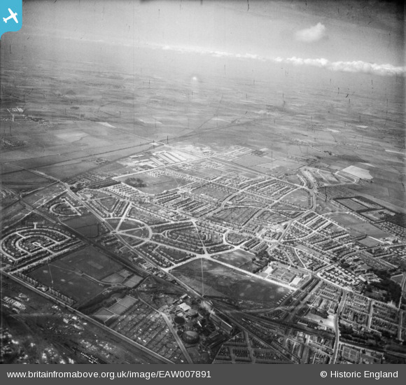
EAW007891 ENGLAND (1947). The residential area at Chirton, North Shields, from the east, 1947
© Copyright OpenStreetMap contributors and licensed by the OpenStreetMap Foundation. 2025. Cartography is licensed as CC BY-SA.
Details
| Title | [EAW007891] The residential area at Chirton, North Shields, from the east, 1947 |
| Reference | EAW007891 |
| Date | 27-June-1947 |
| Link | |
| Place name | NORTH SHIELDS |
| Parish | |
| District | |
| Country | ENGLAND |
| Easting / Northing | 434631, 567966 |
| Longitude / Latitude | -1.4585022339257, 55.004981828319 |
| National Grid Reference | NZ346680 |
Pins
 Adam |
Friday 26th of February 2021 11:19:40 AM | |
 Adam |
Friday 26th of February 2021 11:18:47 AM | |
 Adam |
Friday 26th of February 2021 11:17:19 AM | |
 Adam |
Friday 26th of February 2021 11:16:41 AM | |
 Adam |
Friday 26th of February 2021 11:07:59 AM | |
 Adam |
Friday 26th of February 2021 11:04:38 AM | |
 Adam |
Friday 26th of February 2021 11:04:11 AM | |
 Adam |
Friday 26th of February 2021 11:03:46 AM | |
 Adam |
Friday 26th of February 2021 11:03:26 AM | |
 Adam |
Friday 26th of February 2021 11:02:53 AM | |
 redmist |
Friday 3rd of May 2019 08:55:47 AM | |
 Mr Tynesider |
Wednesday 4th of June 2014 10:57:11 AM |

