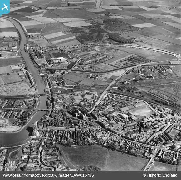
EAW015736 ENGLAND (1948). The town and River Ouse, Selby, 1948
© Copyright OpenStreetMap contributors and licensed by the OpenStreetMap Foundation. 2025. Cartography is licensed as CC BY-SA.
Details
| Title | [EAW015736] The town and River Ouse, Selby, 1948 |
| Reference | EAW015736 |
| Date | 18-May-1948 |
| Link | |
| Place name | SELBY |
| Parish | SELBY |
| District | |
| Country | ENGLAND |
| Easting / Northing | 461802, 432078 |
| Longitude / Latitude | -1.0619808205923, 53.781140204479 |
| National Grid Reference | SE618321 |
Pins
 Ferrers |
Thursday 17th of November 2022 11:34:21 AM | |
 redmist |
Tuesday 12th of May 2020 07:12:01 PM | |
 Brian |
Saturday 25th of April 2020 08:34:21 PM | |
 Siward |
Saturday 20th of April 2019 04:08:14 PM | |
 John Wass |
Saturday 27th of October 2018 07:28:26 PM | |
 John Wass |
Saturday 27th of October 2018 07:25:48 PM | |
 John Wass |
Saturday 27th of October 2018 07:24:16 PM | |
 John Wass |
Saturday 27th of October 2018 07:23:09 PM | |
 John Wass |
Saturday 27th of October 2018 07:21:22 PM | |
 John Wass |
Saturday 27th of October 2018 07:19:13 PM | |
 smiley |
Friday 20th of May 2016 11:38:52 PM | |
 kevin n |
Tuesday 17th of December 2013 12:38:41 PM | |
 kevin n |
Tuesday 17th of December 2013 12:35:23 PM |

