
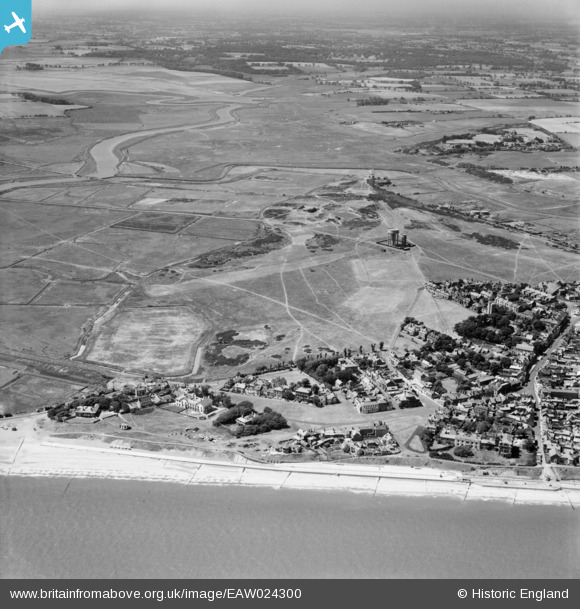
EAW024300 ENGLAND (1949). Southwold Common, Southwold, 1949
© Copyright OpenStreetMap contributors and licensed by the OpenStreetMap Foundation. 2025. Cartography is licensed as CC BY-SA.
Details
| Title | [EAW024300] Southwold Common, Southwold, 1949 |
| Reference | EAW024300 |
| Date | 4-July-1949 |
| Link | |
| Place name | SOUTHWOLD |
| Parish | SOUTHWOLD |
| District | |
| Country | ENGLAND |
| Easting / Northing | 650402, 276014 |
| Longitude / Latitude | 1.6751106352779, 52.324594911592 |
| National Grid Reference | TM504760 |
Pins
 SteveCBR |
Friday 8th of September 2023 02:50:57 PM | |
SteveCBR |
Friday 8th of September 2023 02:50:30 PM | |
redmist |
Thursday 1st of October 2020 08:46:40 PM | |
redmist |
Thursday 18th of April 2019 09:34:56 PM | |
 sirdouglas |
Tuesday 27th of September 2016 07:43:42 PM | |
This railway opened in 1879, and was a 3ft gauge line. It connected with the standard gauge main line at Halesworth. It lost passengers to buses after WW1, and was closed in 1929. |
John W |
Monday 6th of March 2017 05:23:20 PM |
David Emery |
Sunday 31st of August 2014 07:55:28 PM |