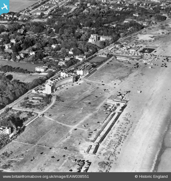
EAW038551 ENGLAND (1951). The beach by Norfolk Crescent, Hayling Island, 1951. This image has been produced from a copy-negative.
© Copyright OpenStreetMap contributors and licensed by the OpenStreetMap Foundation. 2024. Cartography is licensed as CC BY-SA.
Details
| Title | [EAW038551] The beach by Norfolk Crescent, Hayling Island, 1951. This image has been produced from a copy-negative. |
| Reference | EAW038551 |
| Date | 10-August-1951 |
| Link | |
| Place name | HAYLING ISLAND |
| Parish | |
| District | |
| Country | ENGLAND |
| Easting / Northing | 471191, 98917 |
| Longitude / Latitude | -0.98999919180464, 50.784883883297 |
| National Grid Reference | SZ712989 |
Pins
 redmist |
Saturday 28th of January 2023 04:26:04 PM | |
 redmist |
Saturday 28th of January 2023 04:24:52 PM | |
 redmist |
Saturday 28th of January 2023 04:24:29 PM | |
 Bob Pitman |
Thursday 14th of September 2017 04:52:55 PM | |
 Bob Pitman |
Thursday 14th of September 2017 04:36:08 PM | |
 Bob Pitman |
Thursday 14th of September 2017 03:58:26 PM | |
 envelope |
Monday 15th of May 2017 03:08:56 PM |


![[EAW038551] The beach by Norfolk Crescent, Hayling Island, 1951. This image has been produced from a copy-negative.](http://britainfromabove.org.uk/sites/all/libraries/aerofilms-images/public/100x100/EAW/038/EAW038551.jpg)
![[EAW030880] Hayling Bay, South Hayling, from the west, 1950](http://britainfromabove.org.uk/sites/all/libraries/aerofilms-images/public/100x100/EAW/030/EAW030880.jpg)