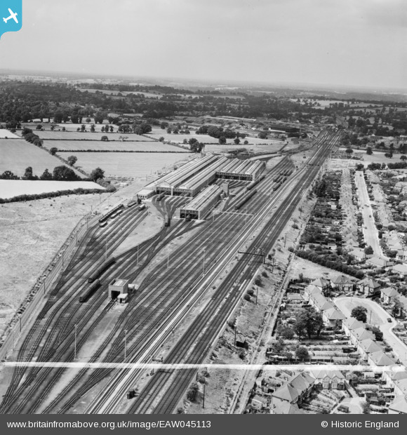
EAW045113 ENGLAND (1952). The London Transport Executive West Ruislip Depot and environs, Ruislip, from the east, 1952. This image was marked by Aerofilms Ltd for photo editing.
© Copyright OpenStreetMap contributors and licensed by the OpenStreetMap Foundation. 2025. Cartography is licensed as CC BY-SA.
Details
| Title | [EAW045113] The London Transport Executive West Ruislip Depot and environs, Ruislip, from the east, 1952. This image was marked by Aerofilms Ltd for photo editing. |
| Reference | EAW045113 |
| Date | 29-July-1952 |
| Link | |
| Place name | RUISLIP |
| Parish | |
| District | |
| Country | ENGLAND |
| Easting / Northing | 509675, 186156 |
| Longitude / Latitude | -0.41757438096993, 51.563127331478 |
| National Grid Reference | TQ097862 |
Pins
 Des Elmes |
Wednesday 14th of December 2022 01:31:47 AM | |
 Des Elmes |
Wednesday 14th of December 2022 01:30:30 AM | |
 The Laird |
Thursday 28th of May 2015 05:51:49 PM | |
 The Laird |
Wednesday 29th of April 2015 04:25:58 PM | |
 The Laird |
Wednesday 29th of April 2015 04:24:27 PM | |
 The Laird |
Wednesday 29th of April 2015 04:21:14 PM | |
 The Laird |
Wednesday 29th of April 2015 04:20:16 PM |

