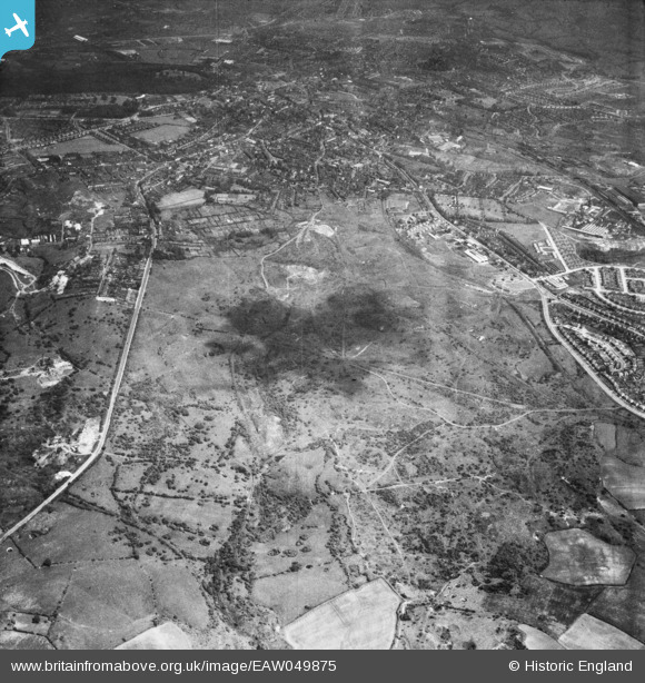
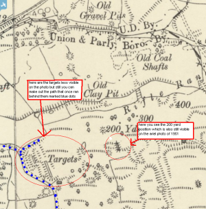
EAW049875 ENGLAND (1953). The site for Russells Hall Estate at the former Old Park Colliery, Dudley, 1953
© Copyright OpenStreetMap contributors and licensed by the OpenStreetMap Foundation. 2024. Cartography is licensed as CC BY-SA.
Details
| Title | [EAW049875] The site for Russells Hall Estate at the former Old Park Colliery, Dudley, 1953 |
| Reference | EAW049875 |
| Date | 11-June-1953 |
| Link | |
| Place name | DUDLEY |
| Parish | |
| District | |
| Country | ENGLAND |
| Easting / Northing | 392666, 289999 |
| Longitude / Latitude | -2.1080674484079, 52.507469983558 |
| National Grid Reference | SO927900 |
Pins
 black country history hunter |
Tuesday 8th of December 2015 10:16:23 PM | |
 black country history hunter |
Tuesday 8th of December 2015 10:15:00 PM | |
 black country history hunter |
Tuesday 8th of December 2015 10:09:56 PM | |
 black country history hunter |
Tuesday 8th of December 2015 10:09:56 PM | |
 black country history hunter |
Saturday 24th of October 2015 11:28:36 PM | |
 black country history hunter |
Saturday 24th of October 2015 11:24:28 PM | |
 black country history hunter |
Saturday 24th of October 2015 11:04:52 PM | |
 black country history hunter |
Saturday 24th of October 2015 11:03:50 PM | |
 black country history hunter |
Friday 18th of September 2015 09:14:44 PM | |
Amazing |
 black country history hunter |
Friday 1st of June 2018 06:01:59 PM |
 black country history hunter |
Friday 18th of September 2015 09:03:36 PM | |
 black country history hunter |
Friday 18th of September 2015 09:02:33 PM | |
 black country history hunter |
Friday 18th of September 2015 08:41:30 PM | |
 black country history hunter |
Friday 18th of September 2015 08:26:40 PM | |
 Davidh |
Saturday 24th of January 2015 08:17:37 PM |


