
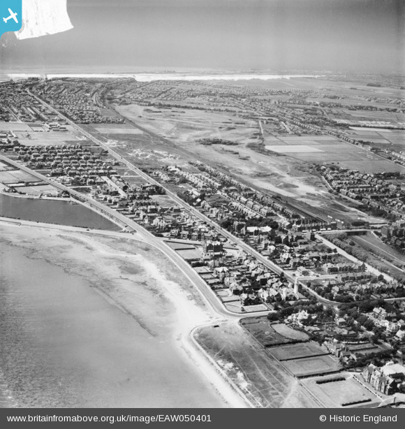
EAW050401 ENGLAND (1953). Stanner Bank, the Inner Promenade, Clifton Drive and environs, Lytham St Anne's, from the south-east, 1953
© Copyright OpenStreetMap contributors and licensed by the OpenStreetMap Foundation. 2025. Cartography is licensed as CC BY-SA.
Details
| Title | [EAW050401] Stanner Bank, the Inner Promenade, Clifton Drive and environs, Lytham St Anne's, from the south-east, 1953 |
| Reference | EAW050401 |
| Date | 3-July-1953 |
| Link | |
| Place name | LYTHAM ST ANNE'S |
| Parish | |
| District | |
| Country | ENGLAND |
| Easting / Northing | 334720, 427236 |
| Longitude / Latitude | -2.9897752927822, 53.737197096357 |
| National Grid Reference | SD347272 |
Pins
 Matt Aldred edob.mattaldred.com |
Monday 31st of March 2025 07:01:35 PM | |
 redmist |
Thursday 11th of February 2021 08:19:27 PM | |
Ian |
Wednesday 27th of May 2015 12:22:51 PM | |
wadey |
Friday 19th of September 2014 04:39:29 PM | |
wadey |
Friday 19th of September 2014 04:34:59 PM |