
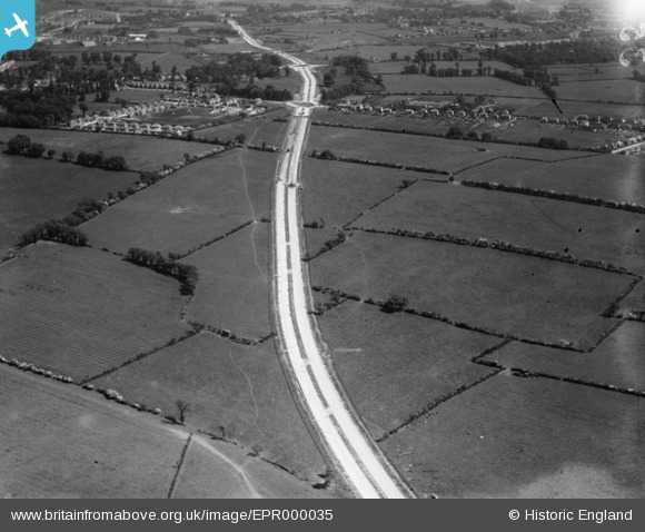
EPR000035 ENGLAND (1934). Western Avenue under construction, Northolt, 1934
© Copyright OpenStreetMap contributors and licensed by the OpenStreetMap Foundation. 2025. Cartography is licensed as CC BY-SA.
Details
| Title | [EPR000035] Western Avenue under construction, Northolt, 1934 |
| Reference | EPR000035 |
| Date | 30-May-1934 |
| Link | |
| Place name | NORTHOLT |
| Parish | |
| District | |
| Country | ENGLAND |
| Easting / Northing | 511766, 184283 |
| Longitude / Latitude | -0.38801288641069, 51.545880598743 |
| National Grid Reference | TQ118843 |

