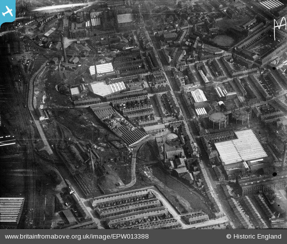
EPW013388 ENGLAND (1925). Brook Side Cotton Mill and surrounds, Darwen, 1925
© Copyright OpenStreetMap contributors and licensed by the OpenStreetMap Foundation. 2024. Cartography is licensed as CC BY-SA.
Details
| Title | [EPW013388] Brook Side Cotton Mill and surrounds, Darwen, 1925 |
| Reference | EPW013388 |
| Date | June-1925 |
| Link | |
| Place name | DARWEN |
| Parish | |
| District | |
| Country | ENGLAND |
| Easting / Northing | 369036, 422642 |
| Longitude / Latitude | -2.469046322905, 53.699069818576 |
| National Grid Reference | SD690226 |
Pins
 ewoodeddie1968 |
Monday 26th of September 2022 06:56:29 PM | |
 powerpop |
Tuesday 28th of October 2014 04:35:46 PM | |
 powerpop |
Tuesday 28th of October 2014 04:35:25 PM | |
 powerpop |
Tuesday 28th of October 2014 04:34:11 PM | |
 powerpop |
Tuesday 28th of October 2014 04:33:41 PM |

