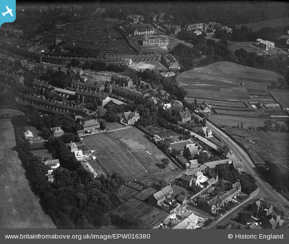
EPW016380 ENGLAND (1926). Neville's Cross, Durham, 1926
© Copyright OpenStreetMap contributors and licensed by the OpenStreetMap Foundation. 2024. Cartography is licensed as CC BY-SA.
Details
| Title | [EPW016380] Neville's Cross, Durham, 1926 |
| Reference | EPW016380 |
| Date | 29-July-1926 |
| Link | |
| Place name | DURHAM |
| Parish | |
| District | |
| Country | ENGLAND |
| Easting / Northing | 426476, 542103 |
| Longitude / Latitude | -1.5883878584376, 54.773047788705 |
| National Grid Reference | NZ265421 |
Pins
 mannidaze |
Tuesday 7th of December 2021 04:34:00 PM | |
 mannidaze |
Tuesday 7th of December 2021 04:33:00 PM | |
 mannidaze |
Tuesday 7th of December 2021 04:31:58 PM | |
 Val |
Saturday 26th of November 2016 01:23:38 PM | |
 Val |
Saturday 26th of November 2016 01:23:35 PM | |
 Roger Cornwell |
Tuesday 11th of February 2014 01:00:52 PM | |
 anwyn |
Tuesday 24th of July 2012 09:03:34 PM | |
Yes, you're right, it's Farnley Tower. When I moved here in the mid-seventies it was a nurses' home. The road heading off to the left would be Farnley Hay Road. |
 Roger Cornwell |
Tuesday 11th of February 2014 12:58:47 PM |
 jif |
Tuesday 10th of July 2012 12:26:50 PM | |
 jif |
Tuesday 10th of July 2012 12:18:20 PM |
User Comment Contributions
At bottom right the tyre marks show the traffic flow on what was then a busy offset junction on the Great North Road. Traffic from the south turned sharp right (just off this photo) on to Crossgate Peth, then sharp left on to St.John's Road, now a quiet residential street. |
 jif |
Tuesday 10th of July 2012 12:34:28 PM |

