
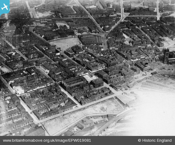
EPW019081 ENGLAND (1927). The town centre, Ashton-Under-Lyne, 1927. This image has been produced from a copy-negative affected by flare.
© Copyright OpenStreetMap contributors and licensed by the OpenStreetMap Foundation. 2025. Cartography is licensed as CC BY-SA.
Details
| Title | [EPW019081] The town centre, Ashton-Under-Lyne, 1927. This image has been produced from a copy-negative affected by flare. |
| Reference | EPW019081 |
| Date | 4-August-1927 |
| Link | |
| Place name | ASHTON-UNDER-LYNE |
| Parish | |
| District | |
| Country | ENGLAND |
| Easting / Northing | 393928, 398992 |
| Longitude / Latitude | -2.0915204323496, 53.487355546002 |
| National Grid Reference | SJ939990 |
Pins
 indiern |
Thursday 7th of December 2023 03:12:59 PM | |
indiern |
Thursday 7th of December 2023 03:11:20 PM | |
indiern |
Thursday 7th of December 2023 03:08:24 PM | |
James |
Sunday 30th of April 2023 06:25:56 PM | |
James |
Sunday 30th of April 2023 06:20:22 PM | |
dodo |
Saturday 2nd of October 2021 06:34:11 PM | |
PennineRover |
Saturday 29th of August 2020 04:21:14 PM | |
PennineRover |
Saturday 29th of August 2020 04:20:36 PM | |
Mikeya |
Monday 10th of February 2020 03:28:10 PM | |
Mikeya |
Monday 10th of February 2020 03:27:36 PM |