
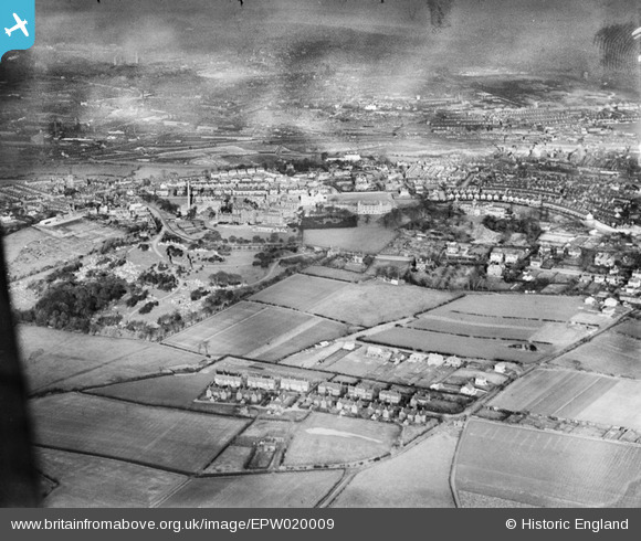
EPW020009 ENGLAND (1927). The North Staffordshire Royal Infirmary, Hartshill, from the south-west, 1927
© Copyright OpenStreetMap contributors and licensed by the OpenStreetMap Foundation. 2024. Cartography is licensed as CC BY-SA.
Details
| Title | [EPW020009] The North Staffordshire Royal Infirmary, Hartshill, from the south-west, 1927 |
| Reference | EPW020009 |
| Date | October-1927 |
| Link | |
| Place name | HARTSHILL |
| Parish | |
| District | |
| Country | ENGLAND |
| Easting / Northing | 386422, 345055 |
| Longitude / Latitude | -2.2023539297974, 53.002333055907 |
| National Grid Reference | SJ864451 |
Pins
 Spraggy1863 |
Thursday 26th of May 2022 03:35:58 PM | |
Tony W |
Tuesday 2nd of March 2021 10:34:40 AM | |
Tony W |
Tuesday 2nd of March 2021 10:33:22 AM | |
Tony W |
Tuesday 2nd of March 2021 10:33:04 AM | |
Tony W |
Tuesday 2nd of March 2021 10:32:44 AM | |
Tony W |
Tuesday 2nd of March 2021 10:32:28 AM | |
Tony W |
Tuesday 2nd of March 2021 10:31:35 AM | |
Katie W |
Saturday 2nd of January 2021 09:23:04 AM | |
Katie W |
Saturday 2nd of January 2021 09:22:27 AM | |
Katie W |
Saturday 2nd of January 2021 09:21:33 AM |