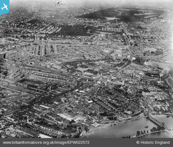
EPW022572 ENGLAND (1928). Brook Green, Hammersmith, from the south-west, 1928
© Copyright OpenStreetMap contributors and licensed by the OpenStreetMap Foundation. 2025. Cartography is licensed as CC BY-SA.
Details
| Title | [EPW022572] Brook Green, Hammersmith, from the south-west, 1928 |
| Reference | EPW022572 |
| Date | 7-August-1928 |
| Link | |
| Place name | HAMMERSMITH |
| Parish | |
| District | |
| Country | ENGLAND |
| Easting / Northing | 523038, 178541 |
| Longitude / Latitude | -0.22752331870558, 51.491925100161 |
| National Grid Reference | TQ230785 |
Pins
 Leslie B |
Saturday 27th of August 2022 05:01:36 PM | |
 Class31 |
Thursday 14th of April 2016 01:42:17 PM | |
 bondi |
Saturday 20th of December 2014 04:04:33 PM | |
 bondi |
Saturday 20th of December 2014 04:03:10 PM | |
 bondi |
Saturday 20th of December 2014 04:02:20 PM | |
 bondi |
Saturday 20th of December 2014 04:00:56 PM | |
 Mike H |
Saturday 25th of January 2014 10:31:24 PM | |
 Gaz |
Sunday 1st of July 2012 11:25:33 AM | |
 Computationist |
Wednesday 27th of June 2012 10:21:14 AM | |
 Computationist |
Wednesday 27th of June 2012 10:20:44 AM |
User Comment Contributions
Hammersmith Bridge, 08/09/2014 |
 Class31 |
Monday 13th of February 2017 08:48:32 PM |


