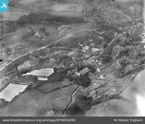
EPW034260 ENGLAND (1930). Salford, Todmorden, 1930
© Copyright OpenStreetMap contributors and licensed by the OpenStreetMap Foundation. 2025. Cartography is licensed as CC BY-SA.
Details
| Title | [EPW034260] Salford, Todmorden, 1930 |
| Reference | EPW034260 |
| Date | July-1930 |
| Link | |
| Place name | TODMORDEN |
| Parish | TODMORDEN |
| District | |
| Country | ENGLAND |
| Easting / Northing | 393522, 423977 |
| Longitude / Latitude | -2.0981591620233, 53.71194832329 |
| National Grid Reference | SD935240 |
Pins
 N166le |
Sunday 29th of September 2024 09:07:57 PM | |
 N166le |
Sunday 29th of September 2024 09:05:40 PM | |
 N166le |
Sunday 29th of September 2024 09:03:58 PM | |
 N166le |
Sunday 29th of September 2024 09:02:12 PM | |
 N166le |
Sunday 29th of September 2024 08:56:42 PM | |
 N166le |
Sunday 29th of September 2024 08:55:33 PM | |
 wadey |
Sunday 9th of April 2023 10:19:41 AM | |
 wadey |
Saturday 8th of November 2014 01:39:06 PM | |
 wadey |
Saturday 8th of November 2014 01:38:32 PM | |
 wadey |
Saturday 8th of November 2014 01:37:06 PM | |
 wadey |
Saturday 8th of November 2014 01:36:30 PM | |
 Class31 |
Sunday 31st of August 2014 07:53:28 PM |


