
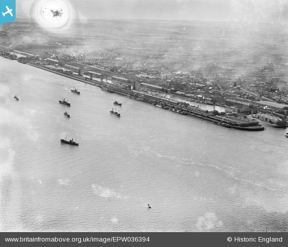
EPW036394 ENGLAND (1931). Albert Dock, the Riverside Quay and the River Humber, Kingston upon Hull, from the east, 1931. This image has been produced from a damaged negative.
© Copyright OpenStreetMap contributors and licensed by the OpenStreetMap Foundation. 2025. Cartography is licensed as CC BY-SA.
Details
| Title | [EPW036394] Albert Dock, the Riverside Quay and the River Humber, Kingston upon Hull, from the east, 1931. This image has been produced from a damaged negative. |
| Reference | EPW036394 |
| Date | August-1931 |
| Link | |
| Place name | KINGSTON UPON HULL |
| Parish | |
| District | |
| Country | ENGLAND |
| Easting / Northing | 509765, 427623 |
| Longitude / Latitude | -0.33585545667582, 53.733208334684 |
| National Grid Reference | TA098276 |
Pins
 John Wass |
Saturday 13th of September 2014 08:02:06 PM |