
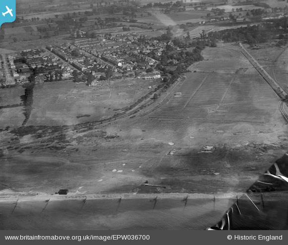
EPW036700 ENGLAND (1931). The Marsh Rifle Range and St Andrew's Church, Cambridge Town, 1931. This image has been produced from a damaged negative.
© Copyright OpenStreetMap contributors and licensed by the OpenStreetMap Foundation. 2025. Cartography is licensed as CC BY-SA.
Details
| Title | [EPW036700] The Marsh Rifle Range and St Andrew's Church, Cambridge Town, 1931. This image has been produced from a damaged negative. |
| Reference | EPW036700 |
| Date | September-1931 |
| Link | |
| Place name | CAMBRIDGE TOWN |
| Parish | |
| District | |
| Country | ENGLAND |
| Easting / Northing | 592982, 184269 |
| Longitude / Latitude | 0.7821742603169, 51.523831376351 |
| National Grid Reference | TQ930843 |
Pins
Be the first to add a comment to this image!