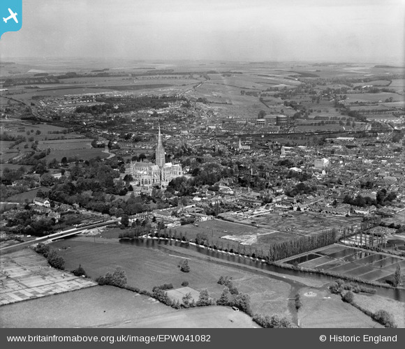
EPW041082 ENGLAND (1933). Salisbury Cathedral and the city, Salisbury, from the south-east, 1933
© Copyright OpenStreetMap contributors and licensed by the OpenStreetMap Foundation. 2025. Cartography is licensed as CC BY-SA.
Details
| Title | [EPW041082] Salisbury Cathedral and the city, Salisbury, from the south-east, 1933 |
| Reference | EPW041082 |
| Date | May-1933 |
| Link | |
| Place name | SALISBURY |
| Parish | SALISBURY |
| District | |
| Country | ENGLAND |
| Easting / Northing | 414720, 129179 |
| Longitude / Latitude | -1.7899257279177, 51.061225604495 |
| National Grid Reference | SU147292 |
Pins
 Maggie |
Tuesday 3rd of November 2020 07:51:45 PM | |
 Maggie |
Thursday 29th of October 2020 08:42:53 PM | |
 gBr |
Tuesday 14th of March 2017 11:12:43 AM | |
 Lee |
Tuesday 14th of March 2017 05:03:28 AM | |
 Lee |
Tuesday 14th of March 2017 05:01:29 AM | |
 Class31 |
Wednesday 15th of January 2014 05:10:25 PM | |
 Class31 |
Monday 21st of October 2013 09:48:27 PM | |
 Class31 |
Monday 21st of October 2013 09:42:32 PM | |
 Class31 |
Monday 21st of October 2013 09:42:04 PM |

