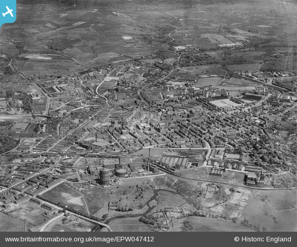
EPW047412 ENGLAND (1935). The town and environs, Hyde, from the south-west, 1935
© Copyright OpenStreetMap contributors and licensed by the OpenStreetMap Foundation. 2025. Cartography is licensed as CC BY-SA.
Details
| Title | [EPW047412] The town and environs, Hyde, from the south-west, 1935 |
| Reference | EPW047412 |
| Date | May-1935 |
| Link | |
| Place name | HYDE |
| Parish | |
| District | |
| Country | ENGLAND |
| Easting / Northing | 394375, 394834 |
| Longitude / Latitude | -2.0847085653204, 53.449982177902 |
| National Grid Reference | SJ944948 |
Pins
 manutdmrs |
Tuesday 25th of January 2022 11:26:54 PM | |
 SteveTamburello |
Monday 12th of April 2021 10:25:21 AM | |
 manutdmrs |
Monday 29th of March 2021 11:37:18 PM | |
 manutdmrs |
Sunday 29th of October 2017 12:17:14 AM | |
 manutdmrs |
Friday 9th of October 2015 09:24:29 PM | |
 stardelta |
Sunday 15th of June 2014 09:40:17 AM | |
 stardelta |
Sunday 15th of June 2014 09:39:04 AM | |
 stardelta |
Sunday 15th of June 2014 09:36:25 AM | |
 stardelta |
Thursday 12th of June 2014 03:01:33 PM | |
 stardelta |
Thursday 12th of June 2014 03:00:12 PM | |
 stardelta |
Thursday 12th of June 2014 02:56:57 PM | |
 stardelta |
Thursday 12th of June 2014 02:56:13 PM | |
 stardelta |
Thursday 12th of June 2014 02:54:01 PM |

