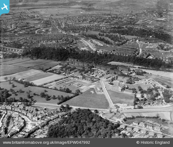
EPW047992 ENGLAND (1935). The City General Hospital (Northern General Hospital) and environs, Sheffield, 1935
© Copyright OpenStreetMap contributors and licensed by the OpenStreetMap Foundation. 2025. Cartography is licensed as CC BY-SA.
Details
| Title | [EPW047992] The City General Hospital (Northern General Hospital) and environs, Sheffield, 1935 |
| Reference | EPW047992 |
| Date | June-1935 |
| Link | |
| Place name | SHEFFIELD |
| Parish | |
| District | |
| Country | ENGLAND |
| Easting / Northing | 436165, 390685 |
| Longitude / Latitude | -1.4558701069459, 53.411474946309 |
| National Grid Reference | SK362907 |
Pins
 Voldy |
Sunday 12th of April 2020 02:51:26 PM | |
 Voldy |
Thursday 3rd of January 2019 04:07:08 PM | |
 Voldy |
Thursday 3rd of January 2019 04:05:22 PM | |
 Voldy |
Thursday 3rd of January 2019 03:57:02 PM | |
 Voldy |
Thursday 8th of November 2018 09:44:56 AM | |
 travellingpass |
Thursday 15th of January 2015 09:47:09 PM | |
 travellingpass |
Thursday 15th of January 2015 09:46:01 PM | |
 travellingpass |
Thursday 15th of January 2015 09:43:21 PM | |
 MappMan |
Friday 23rd of August 2013 03:48:05 PM | |
 bayleaf |
Friday 23rd of August 2013 03:03:04 PM | |
 bayleaf |
Friday 23rd of August 2013 03:01:44 PM | |
 bayleaf |
Friday 23rd of August 2013 03:01:12 PM |

