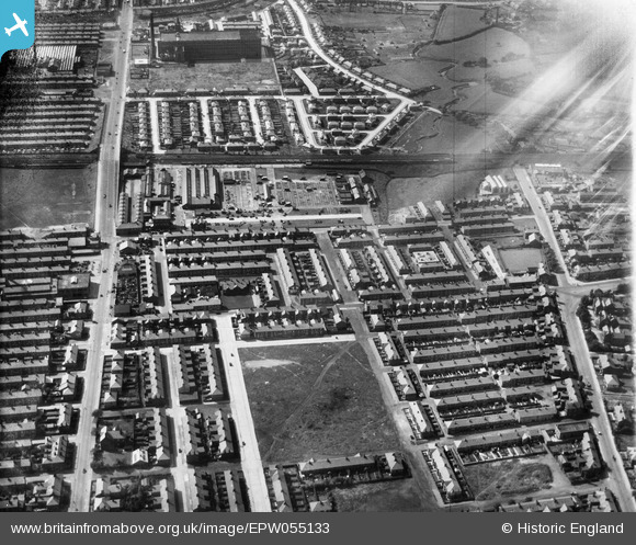
EPW055133 ENGLAND (1937). The cattle market and environs, Preston, 1937
© Copyright OpenStreetMap contributors and licensed by the OpenStreetMap Foundation. 2025. Cartography is licensed as CC BY-SA.
Details
| Title | [EPW055133] The cattle market and environs, Preston, 1937 |
| Reference | EPW055133 |
| Date | August-1937 |
| Link | |
| Place name | PRESTON |
| Parish | |
| District | |
| Country | ENGLAND |
| Easting / Northing | 352915, 431206 |
| Longitude / Latitude | -2.714536277759, 53.774841616896 |
| National Grid Reference | SD529312 |
Pins
 Stewart Thompson |
Sunday 16th of January 2022 05:50:51 PM | |
 Stewart Thompson |
Sunday 16th of January 2022 05:43:25 PM | |
 Stewart Thompson |
Sunday 16th of January 2022 05:42:10 PM | |
 Stewart Thompson |
Sunday 16th of January 2022 05:41:39 PM | |
 Stewart Thompson |
Sunday 16th of January 2022 05:41:15 PM | |
 Stewart Thompson |
Sunday 16th of January 2022 05:38:53 PM | |
 TomRobin |
Wednesday 27th of November 2013 12:33:23 PM | |
 Class31 |
Wednesday 27th of November 2013 11:38:45 AM | |
 Class31 |
Wednesday 27th of November 2013 11:37:22 AM | |
 Class31 |
Wednesday 27th of November 2013 11:36:39 AM | |
 Class31 |
Wednesday 27th of November 2013 11:35:40 AM | |
 Class31 |
Wednesday 27th of November 2013 11:34:40 AM | |
 Class31 |
Wednesday 27th of November 2013 11:33:33 AM |
User Comment Contributions
View is looking west |
 Class31 |
Wednesday 27th of November 2013 11:33:52 AM |

