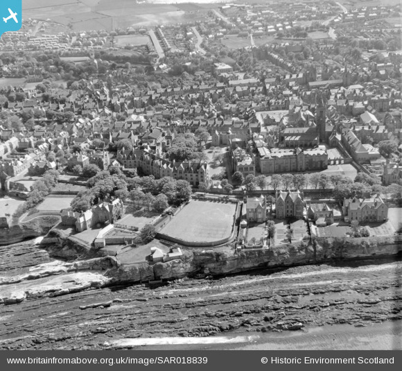
SAR018839 SCOTLAND (1953). General View St Andrews and St Leonards, Fife, Scotland. An oblique aerial photograph taken facing South. This image was marked by AeroPictorial Ltd for photo editing.
© Copyright OpenStreetMap contributors and licensed by the OpenStreetMap Foundation. 2024. Cartography is licensed as CC BY-SA.
Nearby Images (7)
Details
| Title | [SAR018839] General View St Andrews and St Leonards, Fife, Scotland. An oblique aerial photograph taken facing South. This image was marked by AeroPictorial Ltd for photo editing. |
| Reference | SAR018839 |
| Date | 1953 |
| Link | Canmore Collection item 1438136 |
| Place name | |
| Parish | ST ANDREWS AND ST LEONARDS |
| District | NORTH EAST FIFE |
| Country | SCOTLAND |
| Easting / Northing | 351000, 716880 |
| Longitude / Latitude | -2.7927588797854, 56.341825990196 |
| National Grid Reference | NO510169 |
Pins
Be the first to add a comment to this image!


![[SAR018836] General View St Andrews and St Leonards, Fife, Scotland. An oblique aerial photograph taken facing South/East. This image was marked by AeroPictorial Ltd for photo editing.](http://britainfromabove.org.uk/sites/all/libraries/aerofilms-images/public/100x100/SAR/018/SAR018836.jpg)
![[SAR018837] General View St Andrews and St Leonards, Fife, Scotland. An oblique aerial photograph taken facing North/West. This image was marked by AeroPictorial Ltd for photo editing.](http://britainfromabove.org.uk/sites/all/libraries/aerofilms-images/public/100x100/SAR/018/SAR018837.jpg)
![[SAR018838] General View St Andrews and St Leonards, Fife, Scotland. An oblique aerial photograph taken facing North/East. This image was marked by AeroPictorial Ltd for photo editing.](http://britainfromabove.org.uk/sites/all/libraries/aerofilms-images/public/100x100/SAR/018/SAR018838.jpg)
![[SAR018839] General View St Andrews and St Leonards, Fife, Scotland. An oblique aerial photograph taken facing South. This image was marked by AeroPictorial Ltd for photo editing.](http://britainfromabove.org.uk/sites/all/libraries/aerofilms-images/public/100x100/SAR/018/SAR018839.jpg)
![[SAR018840] General View St Andrews and St Leonards, Fife, Scotland. An oblique aerial photograph taken facing North/East. This image was marked by AeroPictorial Ltd for photo editing.](http://britainfromabove.org.uk/sites/all/libraries/aerofilms-images/public/100x100/SAR/018/SAR018840.jpg)
![[SPW040389] St Andrews, general view, showing Castlecliff House, The Scores and St Andrews Castle. An oblique aerial photograph taken facing west.](http://britainfromabove.org.uk/sites/all/libraries/aerofilms-images/public/100x100/SPW/040/SPW040389.jpg)
![[SAW009812] St Andrews, general view, showing Parish Church of the Holy Trinity and Madras College. An oblique aerial photograph taken facing south-west.](http://britainfromabove.org.uk/sites/all/libraries/aerofilms-images/public/100x100/SAW/009/SAW009812.jpg)