
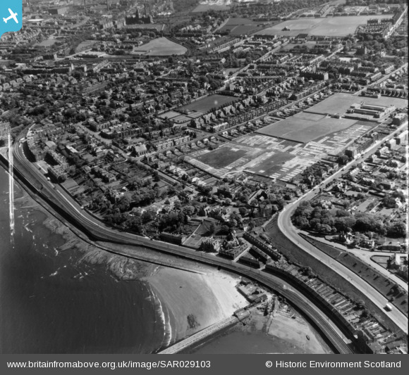
SAR029103 SCOTLAND (1957). Trinity Edinburgh, Midlothian, Scotland. An oblique aerial photograph taken facing South/East. This image was marked by AeroPictorial Ltd for photo editing.
© Copyright OpenStreetMap contributors and licensed by the OpenStreetMap Foundation. 2025. Cartography is licensed as CC BY-SA.
Details
| Title | [SAR029103] Trinity Edinburgh, Midlothian, Scotland. An oblique aerial photograph taken facing South/East. This image was marked by AeroPictorial Ltd for photo editing. |
| Reference | SAR029103 |
| Date | 1957 |
| Link | Canmore Collection item 1438511 |
| Place name | |
| Parish | EDINBURGH (EDINBURGH, CITY OF) |
| District | CITY OF EDINBURGH |
| Country | SCOTLAND |
| Easting / Northing | 325000, 676000 |
| Longitude / Latitude | -3.2017984435431, 55.971175565147 |
| National Grid Reference | NT250760 |
Pins
 Andy A |
Monday 3rd of February 2025 05:56:09 PM | |
david |
Friday 9th of April 2021 10:38:06 PM | |
david |
Friday 9th of April 2021 10:35:36 PM | |
admilne |
Sunday 12th of July 2020 01:04:50 PM | |
admilne |
Sunday 12th of July 2020 01:04:20 PM | |
admilne |
Sunday 12th of July 2020 01:01:14 PM | |
admilne |
Sunday 12th of July 2020 12:57:28 PM | |
admilne |
Sunday 12th of July 2020 12:56:46 PM | |
admilne |
Sunday 12th of July 2020 12:55:16 PM | |
admilne |
Sunday 12th of July 2020 12:54:21 PM | |
admilne |
Sunday 12th of July 2020 12:54:02 PM | |
admilne |
Sunday 12th of July 2020 12:51:45 PM | |
J P McL |
Saturday 11th of March 2017 10:36:13 PM |