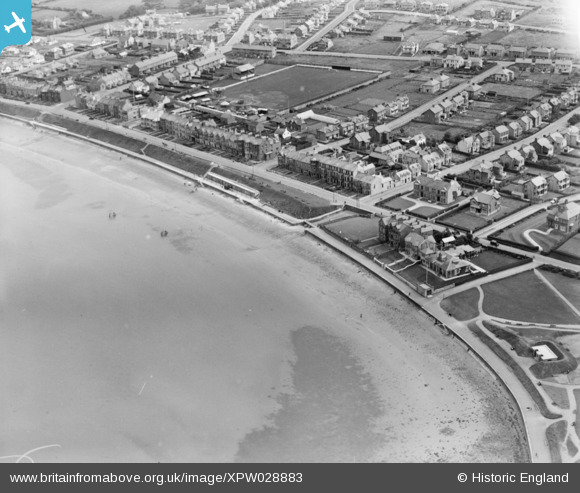
XPW028883 NORTHERN IRELAND (1929). General View, Bangor, North Down, Northern Ireland, 1929. Oblique aerial photograph taken facing South/East.
© Copyright OpenStreetMap contributors and licensed by the OpenStreetMap Foundation. 2025. Cartography is licensed as CC BY-SA.
Details
| Title | [XPW028883] General View, Bangor, North Down, Northern Ireland, 1929. Oblique aerial photograph taken facing South/East. |
| Reference | XPW028883 |
| Date | 1929 |
| Link | |
| Place name | BANGOR |
| Parish | NORTHERN IRELAND |
| District | |
| Country | NORTHERN IRELAND |
| Easting / Northing | 164776, 536091 |
| Longitude / Latitude | -5.649061, 54.664855 |
| National Grid Reference |
Pins
 rcurrie |
Wednesday 1st of January 2020 11:34:38 AM | |
 Alan Gowdy |
Friday 7th of November 2014 11:19:57 PM | |
 Alan Gowdy |
Friday 7th of November 2014 11:03:08 PM | |
 Alan Gowdy |
Friday 7th of November 2014 10:54:10 PM | |
 Alan Gowdy |
Friday 7th of November 2014 10:51:00 PM | |
 Alan Gowdy |
Friday 7th of November 2014 10:49:38 PM | |
 Alan Gowdy |
Friday 7th of November 2014 10:49:07 PM | |
 Alan Gowdy |
Friday 7th of November 2014 10:48:32 PM | |
 Alan Gowdy |
Friday 7th of November 2014 10:46:26 PM | |
 Alan Gowdy |
Friday 7th of November 2014 10:45:05 PM | |
 Alan Gowdy |
Friday 7th of November 2014 10:42:52 PM | |
 Alan Gowdy |
Friday 7th of November 2014 10:42:22 PM | |
 Alan Gowdy |
Friday 7th of November 2014 10:41:40 PM | |
 Alan Gowdy |
Friday 7th of November 2014 10:41:17 PM | |
 Alan Gowdy |
Friday 7th of November 2014 10:40:41 PM |

