
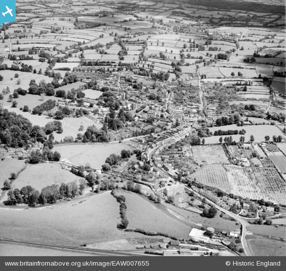
EAW007655 ENGLAND (1947). The town, Ottery St Mary, 1947
© Hawlfraint cyfranwyr OpenStreetMap a thrwyddedwyd gan yr OpenStreetMap Foundation. 2024. Trwyddedir y gartograffeg fel CC BY-SA.
Delweddau cyfagos (3)
EAW007655

EAW007654

EAW007653

Manylion
| Pennawd | [EAW007655] The town, Ottery St Mary, 1947 |
| Cyfeirnod | EAW007655 |
| Dyddiad | 17-June-1947 |
| Dolen | |
| Enw lle | OTTERY ST MARY |
| Plwyf | OTTERY ST. MARY |
| Ardal | |
| Gwlad | ENGLAND |
| Dwyreiniad / Gogleddiad | 309742, 95486 |
| Hydred / Lledred | -3.2796016971387, 50.751379056785 |
| Cyfeirnod Grid Cenedlaethol | SY097955 |
Pinnau
 Adrian |
Sunday 29th of September 2024 10:43:07 PM | |
Charles Dale |
Tuesday 7th of July 2015 09:50:17 PM | |
Allen T |
Thursday 14th of August 2014 06:37:12 PM | |
Allen T |
Thursday 14th of August 2014 06:34:17 PM | |
Allen T |
Thursday 14th of August 2014 06:33:06 PM | |
Allen T |
Thursday 14th of August 2014 06:24:33 PM | |
Allen T |
Thursday 14th of August 2014 06:20:24 PM | |
Allen T |
Thursday 14th of August 2014 06:19:54 PM | |
Allen T |
Thursday 14th of August 2014 06:17:55 PM | |
Allen T |
Thursday 14th of August 2014 06:17:03 PM | |
Allen T |
Thursday 14th of August 2014 06:16:00 PM | |
Allen T |
Thursday 14th of August 2014 06:15:16 PM | |
Allen T |
Thursday 14th of August 2014 06:14:33 PM | |
Allen T |
Thursday 14th of August 2014 05:56:28 PM | |
MB |
Tuesday 12th of November 2013 11:54:36 PM | |
Charles Dale |
Wednesday 6th of November 2013 02:22:01 PM | |
Charles Dale |
Wednesday 6th of November 2013 02:21:14 PM | |
Charles Dale |
Wednesday 6th of November 2013 02:20:21 PM | |
Charles Dale |
Wednesday 6th of November 2013 02:19:40 PM | |
Charles Dale |
Wednesday 6th of November 2013 02:18:53 PM |