
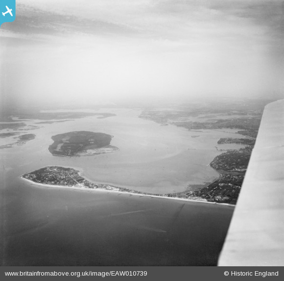
EAW010739 ENGLAND (1947). Sandbanks, Brownsea Island and the Harour, Poole, from the south-east, 1947
© Hawlfraint cyfranwyr OpenStreetMap a thrwyddedwyd gan yr OpenStreetMap Foundation. 2024. Trwyddedir y gartograffeg fel CC BY-SA.
Delweddau cyfagos (8)
EAW010739

EPW061369

EPW061368

EPW061365

EPW061367

EPW061370

EPW041054

EPW061366

Manylion
| Pennawd | [EAW010739] Sandbanks, Brownsea Island and the Harour, Poole, from the south-east, 1947 |
| Cyfeirnod | EAW010739 |
| Dyddiad | 10-September-1947 |
| Dolen | |
| Enw lle | POOLE |
| Plwyf | |
| Ardal | |
| Gwlad | ENGLAND |
| Dwyreiniad / Gogleddiad | 404441, 87951 |
| Hydred / Lledred | -1.9371216563275, 50.690614705596 |
| Cyfeirnod Grid Cenedlaethol | SZ044880 |


