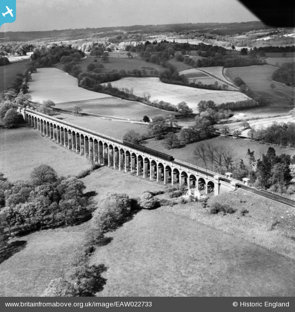
EAW022733 ENGLAND (1949). The Ouse Valley Viaduct, Brook Street, 1949
© Hawlfraint cyfranwyr OpenStreetMap a thrwyddedwyd gan yr OpenStreetMap Foundation. 2024. Trwyddedir y gartograffeg fel CC BY-SA.
Manylion
| Pennawd | [EAW022733] The Ouse Valley Viaduct, Brook Street, 1949 |
| Cyfeirnod | EAW022733 |
| Dyddiad | 29-April-1949 |
| Dolen | |
| Enw lle | BROOK STREET |
| Plwyf | ANSTY AND STAPLEFIELD |
| Ardal | |
| Gwlad | ENGLAND |
| Dwyreiniad / Gogleddiad | 532344, 127808 |
| Hydred / Lledred | -0.11231574009561, 51.033837974577 |
| Cyfeirnod Grid Cenedlaethol | TQ323278 |
Pinnau
 Adrian Backshall |
Friday 18th of December 2020 09:06:40 PM | |
 M Anton |
Wednesday 18th of April 2018 08:17:51 AM | |
 M Anton |
Wednesday 18th of April 2018 08:09:44 AM | |
 John Wass |
Sunday 15th of March 2015 09:05:39 PM | |
 bescotbeast |
Sunday 28th of September 2014 12:57:54 PM | |
 Will Wallace |
Saturday 24th of May 2014 01:52:08 PM |


![[EAW022733] The Ouse Valley Viaduct, Brook Street, 1949](http://britainfromabove.org.uk/sites/all/libraries/aerofilms-images/public/100x100/EAW/022/EAW022733.jpg)
![[EAW022734] The Ouse Valley Viaduct, Brook Street, 1949](http://britainfromabove.org.uk/sites/all/libraries/aerofilms-images/public/100x100/EAW/022/EAW022734.jpg)
