
Scheduled Maintenance
This website will undergo scheduled maintenance on Tuesday, September 10th, between 11:00 and 15:00, as well as on Thursday, September 12th, between 10:00 and 12:00. During this time, services may be temporarily disrupted. We apologise for any inconvenience.
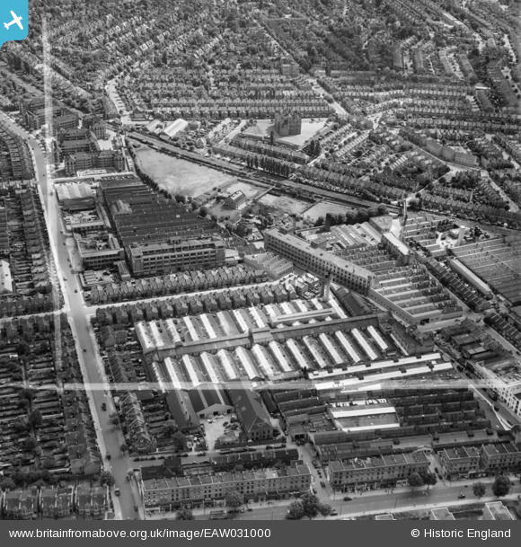
EAW031000 ENGLAND (1950). The Acton Park Industrial Estate and environs, Hammersmith, 1950. This image was marked by Aerofilms Ltd for photo editing.
© Hawlfraint cyfranwyr OpenStreetMap a thrwyddedwyd gan yr OpenStreetMap Foundation. 2024. Trwyddedir y gartograffeg fel CC BY-SA.
Delweddau cyfagos (27)
EAW031000

EPW020852

EPW020846

EPW062158

EPW020856

EPW020850

EPW020848

EAW030997

EPW020849

EAW031006

EPW062161

EAW030999

EAW031004

EAW030998

EPW062163

EAW031002

EPW062160

EPW020847

EPW014096

EAW031005

EAW031001

EPW062162

EPW062164

EPW062159

EAW031003

EPW062165

EPW020855

Manylion
| Pennawd | [EAW031000] The Acton Park Industrial Estate and environs, Hammersmith, 1950. This image was marked by Aerofilms Ltd for photo editing. |
| Cyfeirnod | EAW031000 |
| Dyddiad | 14-July-1950 |
| Dolen | |
| Enw lle | HAMMERSMITH |
| Plwyf | |
| Ardal | |
| Gwlad | ENGLAND |
| Dwyreiniad / Gogleddiad | 521231, 179810 |
| Hydred / Lledred | -0.25310561468327, 51.503721703317 |
| Cyfeirnod Grid Cenedlaethol | TQ212798 |
Pinnau
Byddwch y cyntaf i ychwanegu sylw at y ddelwedd hon!