
Scheduled Maintenance
This website will undergo scheduled maintenance on Tuesday, September 10th, between 11:00 and 15:00, as well as on Thursday, September 12th, between 10:00 and 12:00. During this time, services may be temporarily disrupted. We apologise for any inconvenience.
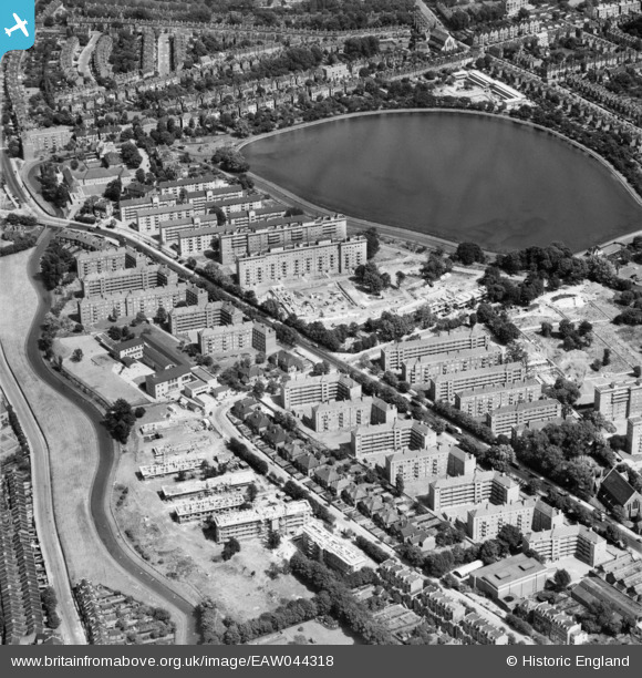
EAW044318 ENGLAND (1952). Seven Sisters Road, the Woodberry Down Estate and East Reservoir, Stamford Hill, 1952
© Hawlfraint cyfranwyr OpenStreetMap a thrwyddedwyd gan yr OpenStreetMap Foundation. 2024. Trwyddedir y gartograffeg fel CC BY-SA.
Delweddau cyfagos (15)
EAW044318

EAW044314

EAW044325

EAW044320

EAW044322

EAW044316

EAW044317

EAW044312

EAW044311

EAW044327

EAW044321

EAW044315

EAW044324

EAW044326

EAW044319

Manylion
| Pennawd | [EAW044318] Seven Sisters Road, the Woodberry Down Estate and East Reservoir, Stamford Hill, 1952 |
| Cyfeirnod | EAW044318 |
| Dyddiad | 24-June-1952 |
| Dolen | |
| Enw lle | STAMFORD HILL |
| Plwyf | |
| Ardal | |
| Gwlad | ENGLAND |
| Dwyreiniad / Gogleddiad | 532477, 187691 |
| Hydred / Lledred | -0.088181272870405, 51.572027205932 |
| Cyfeirnod Grid Cenedlaethol | TQ325877 |
Pinnau
Byddwch y cyntaf i ychwanegu sylw at y ddelwedd hon!