
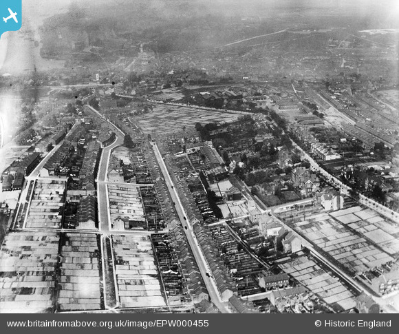
EPW000455 ENGLAND (1920). Dean Street area, Chatham, 1920
© Hawlfraint cyfranwyr OpenStreetMap a thrwyddedwyd gan yr OpenStreetMap Foundation. 2024. Trwyddedir y gartograffeg fel CC BY-SA.
Delweddau cyfagos (2)
EPW000455

EPW013283

Manylion
| Pennawd | [EPW000455] Dean Street area, Chatham, 1920 |
| Cyfeirnod | EPW000455 |
| Dyddiad | 29-April-1920 |
| Dolen | |
| Enw lle | CHATHAM |
| Plwyf | |
| Ardal | |
| Gwlad | ENGLAND |
| Dwyreiniad / Gogleddiad | 575537, 167099 |
| Hydred / Lledred | 0.52243050177446, 51.375271470137 |
| Cyfeirnod Grid Cenedlaethol | TQ755671 |
Pinnau
 Jo |
Sunday 12th of December 2021 10:18:39 AM | |
Switches |
Monday 16th of February 2015 03:26:06 PM | |
Switches |
Tuesday 28th of August 2012 05:55:45 PM | |
Switches |
Tuesday 28th of August 2012 05:54:33 PM | |
Switches |
Tuesday 28th of August 2012 05:51:10 PM | |
Switches |
Tuesday 28th of August 2012 05:50:11 PM | |
Switches |
Tuesday 28th of August 2012 05:48:31 PM | |
Yes, this is Dale Street - I lived at No. 201 until 1951 (I was 10 years old when we moved). Purbeck Road (un-adopted and paved with flint in my time) runs parallel between Dale Street and the Maidstone Road. |
AMcD |
Monday 30th of December 2013 06:28:03 PM |
Switches |
Tuesday 28th of August 2012 05:28:17 PM | |
Ian |
Tuesday 26th of June 2012 08:13:32 AM | |
Ian |
Tuesday 26th of June 2012 08:12:52 AM |
Cyfraniadau Grŵp
Is this the Dean street area or should it be Dale Street? |
Switches |
Monday 23rd of December 2013 08:55:08 PM |