
Scheduled Maintenance
This website will undergo scheduled maintenance on Tuesday, September 10th, between 11:00 and 15:00, as well as on Thursday, September 12th, between 10:00 and 12:00. During this time, services may be temporarily disrupted. We apologise for any inconvenience.
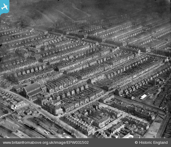
EPW031502 ENGLAND (1930). St Paul's Church and terraced housing surrounding Burgoyne Road, Umfreville Road and Cavendish Road, Harringay, 1930
© Hawlfraint cyfranwyr OpenStreetMap a thrwyddedwyd gan yr OpenStreetMap Foundation. 2024. Trwyddedir y gartograffeg fel CC BY-SA.
Delweddau cyfagos (2)
EPW031502

EPW031662

Manylion
| Pennawd | [EPW031502] St Paul's Church and terraced housing surrounding Burgoyne Road, Umfreville Road and Cavendish Road, Harringay, 1930 |
| Cyfeirnod | EPW031502 |
| Dyddiad | February-1930 |
| Dolen | |
| Enw lle | HARRINGAY |
| Plwyf | |
| Ardal | |
| Gwlad | ENGLAND |
| Dwyreiniad / Gogleddiad | 531644, 188323 |
| Hydred / Lledred | -0.099958531841013, 51.577902423747 |
| Cyfeirnod Grid Cenedlaethol | TQ316883 |
Pinnau
 Class31 |
Wednesday 13th of February 2013 03:05:20 PM | |
Class31 |
Wednesday 13th of February 2013 03:04:57 PM | |
Class31 |
Wednesday 13th of February 2013 03:04:29 PM | |
Class31 |
Wednesday 13th of February 2013 03:03:48 PM | |
Class31 |
Wednesday 13th of February 2013 03:03:16 PM | |
Class31 |
Wednesday 13th of February 2013 03:00:35 PM | |
Class31 |
Wednesday 13th of February 2013 02:54:58 PM | |
Class31 |
Wednesday 13th of February 2013 02:54:24 PM | |
Class31 |
Wednesday 13th of February 2013 02:53:40 PM | |
Class31 |
Wednesday 13th of February 2013 02:52:32 PM |