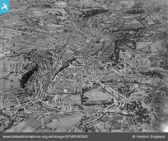
EPW048380 ENGLAND (1935). The city, Bath, from the east, 1935
© Hawlfraint cyfranwyr OpenStreetMap a thrwyddedwyd gan yr OpenStreetMap Foundation. 2024. Trwyddedir y gartograffeg fel CC BY-SA.
Delweddau cyfagos (15)
EPW048380

EAW026450

EPW048403

EAW049898

EAW049899

EAW023885

EAW049901

EPW001957

EPW048377

EAW049900

EPW048402

EAW000755

EAW000758

EAW023884

EPW001937

Manylion
| Pennawd | [EPW048380] The city, Bath, from the east, 1935 |
| Cyfeirnod | EPW048380 |
| Dyddiad | July-1935 |
| Dolen | |
| Enw lle | BATH |
| Plwyf | |
| Ardal | |
| Gwlad | ENGLAND |
| Dwyreiniad / Gogleddiad | 375502, 164765 |
| Hydred / Lledred | -2.3520499154259, 51.380908165903 |
| Cyfeirnod Grid Cenedlaethol | ST755648 |
Pinnau
 |
 Treecutter75 |
Wednesday 6th of November 2013 05:43:56 PM |
 Class31 |
Wednesday 31st of July 2013 09:54:36 PM | |
Class31 |
Wednesday 31st of July 2013 09:52:38 PM | |
 |
Class31 |
Wednesday 31st of July 2013 04:49:55 PM |
Class31 |
Monday 10th of June 2013 09:28:29 PM |