
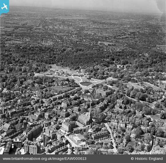
EAW000613 ENGLAND (1946). Christ Church and West Heath, Hampstead, from the south-east, 1946
© Copyright OpenStreetMap contributors and licensed by the OpenStreetMap Foundation. 2024. Cartography is licensed as CC BY-SA.
Nearby Images (16)
EAW000613

EAW000611

EPW056656

EAW000625

EAW000610

EAW014551

EPW011417

EAW014553

EPW056831

EPW056655

EPW028170

EPW026949

EPW056830

EAW000614

EPW000818

EPW056833

Details
| Title | [EAW000613] Christ Church and West Heath, Hampstead, from the south-east, 1946 |
| Reference | EAW000613 |
| Date | 10-May-1946 |
| Link | |
| Place name | HAMPSTEAD |
| Parish | |
| District | |
| Country | ENGLAND |
| Easting / Northing | 526439, 186107 |
| Longitude / Latitude | -0.17583890616431, 51.559177195143 |
| National Grid Reference | TQ264861 |
Pins
 Class31 |
Tuesday 19th of May 2015 07:43:17 AM |
