
Scheduled Maintenance
This website will undergo scheduled maintenance on Tuesday, September 10th, between 11:00 and 15:00, as well as on Thursday, September 12th, between 10:00 and 12:00. During this time, services may be temporarily disrupted. We apologise for any inconvenience.
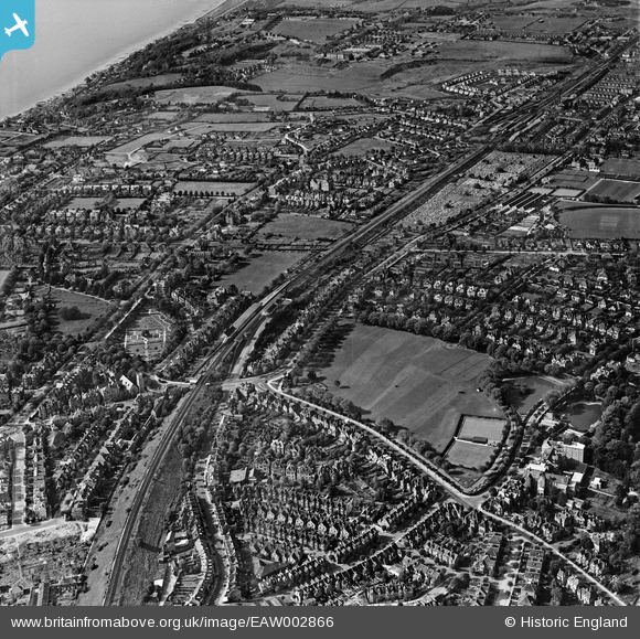
EAW002866 ENGLAND (1946). Central Station, Radnor Park and the surrounding area, Folkestone, 1946
© Copyright OpenStreetMap contributors and licensed by the OpenStreetMap Foundation. 2024. Cartography is licensed as CC BY-SA.
Nearby Images (6)
EAW002866

EAW002369

EAW002865

EAW002368

EAW002864

EAW002367

Details
| Title | [EAW002866] Central Station, Radnor Park and the surrounding area, Folkestone, 1946 |
| Reference | EAW002866 |
| Date | 1-October-1946 |
| Link | |
| Place name | FOLKESTONE |
| Parish | FOLKESTONE |
| District | |
| Country | ENGLAND |
| Easting / Northing | 621950, 136335 |
| Longitude / Latitude | 1.1693372377662, 51.08279676507 |
| National Grid Reference | TR220363 |
Pins
 Mike Floate |
Saturday 4th of January 2014 07:54:36 PM |