
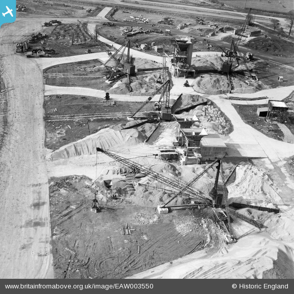
EAW003550 ENGLAND (1947). Construction machinery at Bristol Filton Airport, Catbrain, 1947
© Copyright OpenStreetMap contributors and licensed by the OpenStreetMap Foundation. 2024. Cartography is licensed as CC BY-SA.
Nearby Images (30)
EAW003550

EAW003558

EAW003551

EAW003552

EAW004192

EAW007150

EAW004193

EAW007129

EAW007132

EAW007130

EAW004191

EAW007141

EAW007148

EAW007134

EAW004188

EAW004189

EAW007139

EAW007147

EAW009936

EAW004185

EAW007149

EAW009946

EAW007142

EAW009935

EAW009947

EAW007140

EAW012431

EAW009958

EAW004187

EAW004190

Details
| Title | [EAW003550] Construction machinery at Bristol Filton Airport, Catbrain, 1947 |
| Reference | EAW003550 |
| Date | 3-March-1947 |
| Link | |
| Place name | CATBRAIN |
| Parish | ALMONDSBURY |
| District | |
| Country | ENGLAND |
| Easting / Northing | 359262, 180411 |
| Longitude / Latitude | -2.5872194026982, 51.520665289221 |
| National Grid Reference | ST593804 |
Pins
Be the first to add a comment to this image!