
Scheduled Maintenance
This website will undergo scheduled maintenance on Tuesday, September 10th, between 11:00 and 15:00, as well as on Thursday, September 12th, between 10:00 and 12:00. During this time, services may be temporarily disrupted. We apologise for any inconvenience.
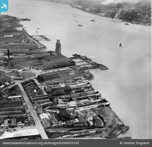
EAW003743 ENGLAND (1947). Clover's Graving Docks and Woodside Station, Birkenhead, 1947
© Copyright OpenStreetMap contributors and licensed by the OpenStreetMap Foundation. 2024. Cartography is licensed as CC BY-SA.
Nearby Images (17)
EAW003743

EAW008559

EAW003744

EAW000414

EAW000412

EAW008562

EAW000413

EAW003745

EAW008666

EAW008662

EAW001807

EAW008718

EAW008664

EAW000411

EAW001720

EAW003740

EAW001719

Details
| Title | [EAW003743] Clover's Graving Docks and Woodside Station, Birkenhead, 1947 |
| Reference | EAW003743 |
| Date | 25-March-1947 |
| Link | |
| Place name | BIRKENHEAD |
| Parish | |
| District | |
| Country | ENGLAND |
| Easting / Northing | 332972, 389197 |
| Longitude / Latitude | -3.0081102234818, 53.39508236677 |
| National Grid Reference | SJ330892 |
Pins
Be the first to add a comment to this image!