
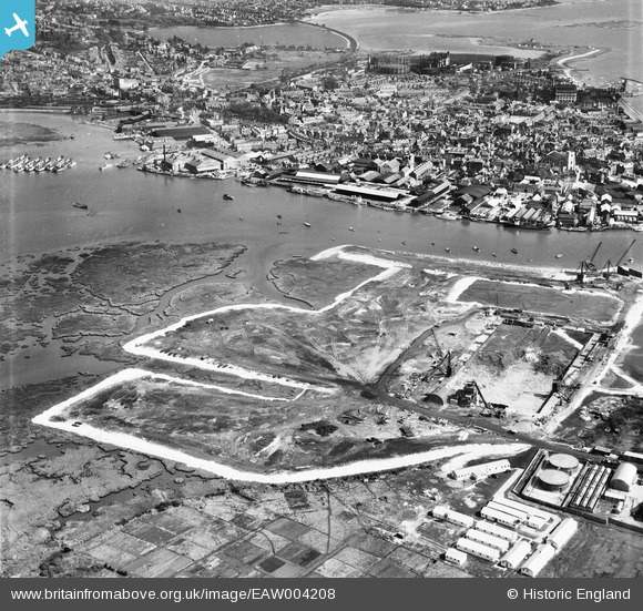
EAW004208 ENGLAND (1947). Land reclamation at the site of Hamworthy Power Station, Poole, from the west, 1947
© Copyright OpenStreetMap contributors and licensed by the OpenStreetMap Foundation. 2024. Cartography is licensed as CC BY-SA.
Nearby Images (27)
EAW004208

EAW004207

EAW019955

EAW019948

EAW004205

EAW004204

EAW019947

EAW019950

EAW004201

EAW004196

EAW004198

EAW019945

EAW004206

EAW004209

EAW019953

EAW004197

EAW004200

EAW019946

EAW004195

EAW019944

EAW004203

EAW004199

EAW019954

EAW019949

EAW004202

EAW019951

EAW004194

Details
| Title | [EAW004208] Land reclamation at the site of Hamworthy Power Station, Poole, from the west, 1947 |
| Reference | EAW004208 |
| Date | 10-April-1947 |
| Link | |
| Place name | POOLE |
| Parish | |
| District | |
| Country | ENGLAND |
| Easting / Northing | 400178, 90686 |
| Longitude / Latitude | -1.9974784495085, 50.715229502503 |
| National Grid Reference | SZ002907 |
